
-
1:16

No shortage of sunshine today
-
1:37

Memorial Day parade forecast
-
4:51

Local band ’The Erly’ stops by ABC57 ahead of June 3 performance
-
1:17

VERY foggy first few hours of the morning
-
1:57

A local taste brings New Carlisle community together on race...
-
0:45

Pancakes help raise funds to support the Alzheimer’s Association
-
1:03

Lighter rain expected into the afternoon
-
1:04

Non-severe storms expected
-
1:16

Showers start this morning
-
1:59

Mac & Cheese festival turns Four Winds Field into a kitchen
-
0:45

Michiana Spring Clay tour encourages people to try and take a...
-
2:56

Fresh Cuts, Fresh Starts: Re-Entry Program Gives Back in Elkhart

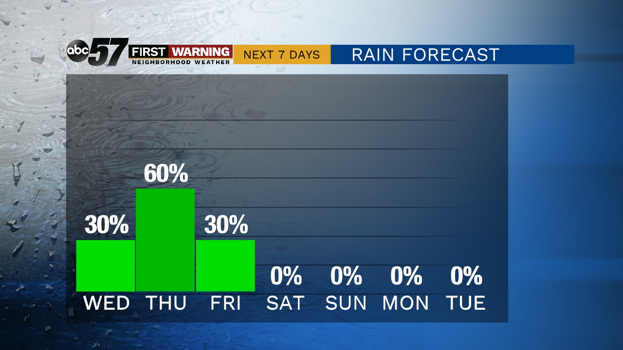
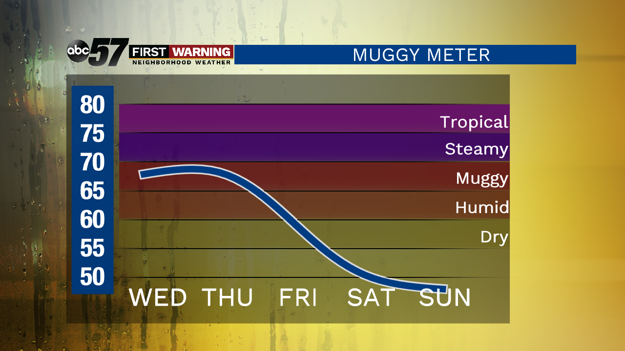
The rest of the week won't be as hot as the chance of showers and storms increases. Most of Wednesday is dry with isolated showers / storms, Thursday is the most likely day for rain with a wide scattering of showers and thunderstorms. The chance of rain lingers through Friday morning. In total upwards of an inch of rain is possible through the end of the week. The heat and humidity drops Friday. You'll be able to have the windows open this weekend, sunny with highs near 70.
Tonight: Partly cloudy. Low 67.
Wednesday: Partly cloudy. Isolated thunderstorms. High 84.
Thursday: Scattered thunderstorms. Mostly cloudy. High 80.
Friday: AM Showers then clearing. High of 70.
Sign up for the ABC 57 Newsletter