Season's first snow on its way
Posted: Nov 7, 2018 12:48 PM EDT
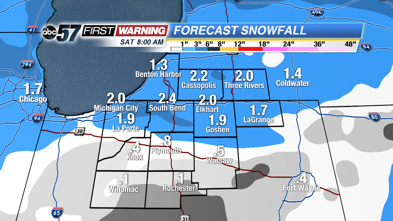
Snow is on its way to Michiana! Yes, it may be early November, but the flakes will fly by Thursday night for nearly everyone. It's still a little early to discuss exact totals, but there is growing confidence in 1-3" falling for many locations. Each of our forecast models has its own idea regarding how much snow will fall, but the consensus appears to be 1-3" as of 1 p.m. Wednesday.
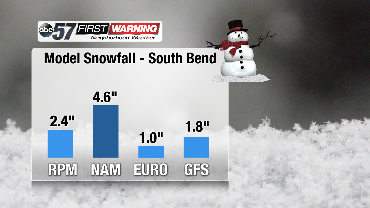
As you can see, the four models we use show amounts from 1" (EURO) to 4.6" (NAM). This is usually the case with snow events because nailing down exact snow totals is oftentimes quite difficult. This is especially true early in the season because the ground is still above freezing, which will likely lead to some of the snow melting initially. Also of importance is the fact that some rain could mix in at times depending on temperatures.
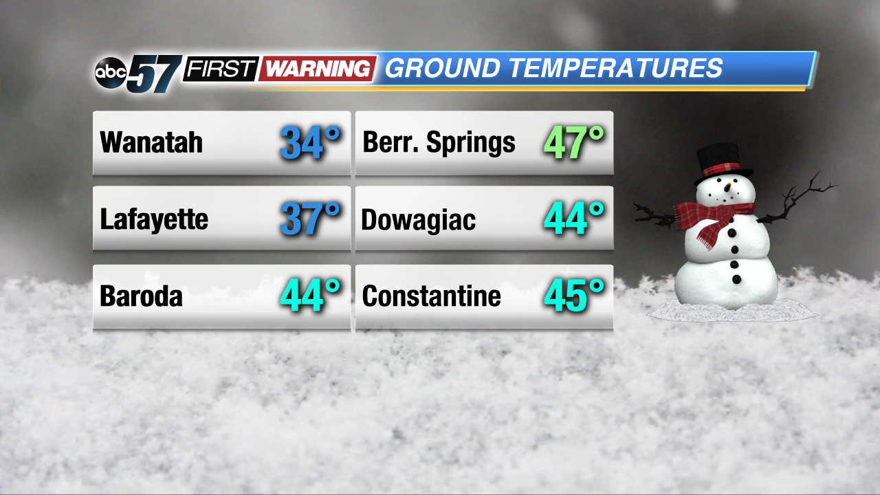
A trend downwards has been occurring over the last several days for ground temperatures. This trend will result in a higher probability of the snow sticking, especially on grassy and elevated surfaces like rooftops and cars. If it comes down hard enough, the roads could become slick in spots. For the most part, ground temperatures are still just above freezing. This will certainly help any salt or brine work efficiently.
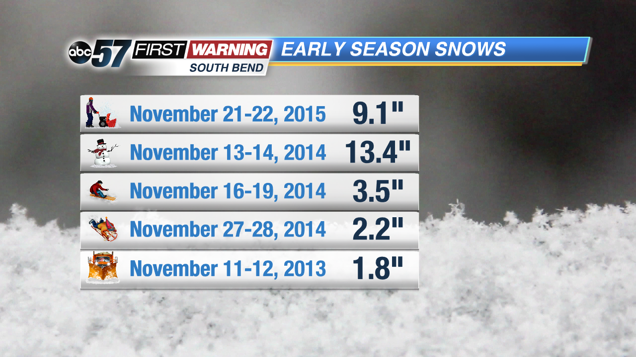
If we do indeed receive 1-3" of snow, it would be about two weeks earlier than normal for South Bend. Typically the city doesn't record its first one inch of snow until late November. Despite this, it wouldn't go down as a rare event. Looking back over the last five years, there have been five different events in which at least one inch of snow fell during the month of November. Three such events occurred in 2014 alone, including a two-day snowstorm that brought over a foot of snow! A usual November brings about 5" of snow to South Bend. We may be more than halfway there by this weekend!


