
-
2:01

The Juneteenth Cultural Alliance hosts Juneteenth celebrations...
-
1:11

Morning rain, breezy afternoon
-
0:53

Showers out the door
-
0:38

Two injured in overnight shooting
-
2:52

Cleanup efforts continue in Kouts after EF-3 Tornado
-
2:04

Michiana PrideFest celebrates its 5th year with a sports theme
-
0:54

Much cooler next week, Highs in the 70s
-
0:53

’Hop On and Hire’ event held Saturday for prospective bus...
-
1:32

Storms return overnight
-
1:30

Pleasant today, storms tonight
-
0:51

Summer-like through today
-
2:00

The South Bend Cubs give up a win to Peoria Friday night

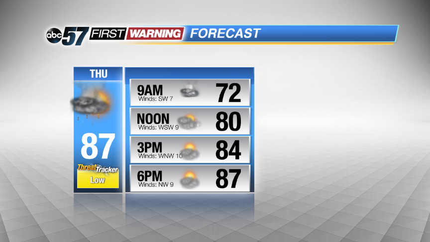
The severe threat is over, steady rain continues until after midnight then ends by Thursday morning. The forecast stays muggy, with a chance of showers and storms through the end of the week. This is a typical summertime weather pattern, storms develop in the late afternoon but may be highly scattered. The severe threat looks low Thursday, in what could be the driest of the next three days.
Tonight: Scattered showers and storms. Some could be strong to severe. Lows near 70.
Thursday: Morning showers and storms then partly sunny, high in the upper 80s.
Friday: PM scattered storms, highs in the upper 80s.
Saturday: More scattered showers and storms, highs in the upper 80s.
Sign up for the ABC 57 Newsletter