
-
3:08

Officials recover body of missing teenager in Lake Michigan off...
-
2:45

NCAA’s new eligibility rule could reshape Notre Dame roster...
-
1:08

Storms start this afternoon
-
0:56

Calm morning, storms tonight
-
2:43

South Bend residents see future plans for former Drewry’s Brewery
-
2:45

Damage assessment continues in Elkhart County following EF-2...
-
0:44

Indiana and Illinois set record for tornadoes
-
1:27

Community Build underway at Kathryn Park
-
2:34

Day two of searching for a missing child continues
-
3:47

The Elkhart community is searching for answers after a 2-year-old...
-
1:04

Overall pleasant for Michiana
-
1:52

South Bend Common Council issues an official apology to residents...

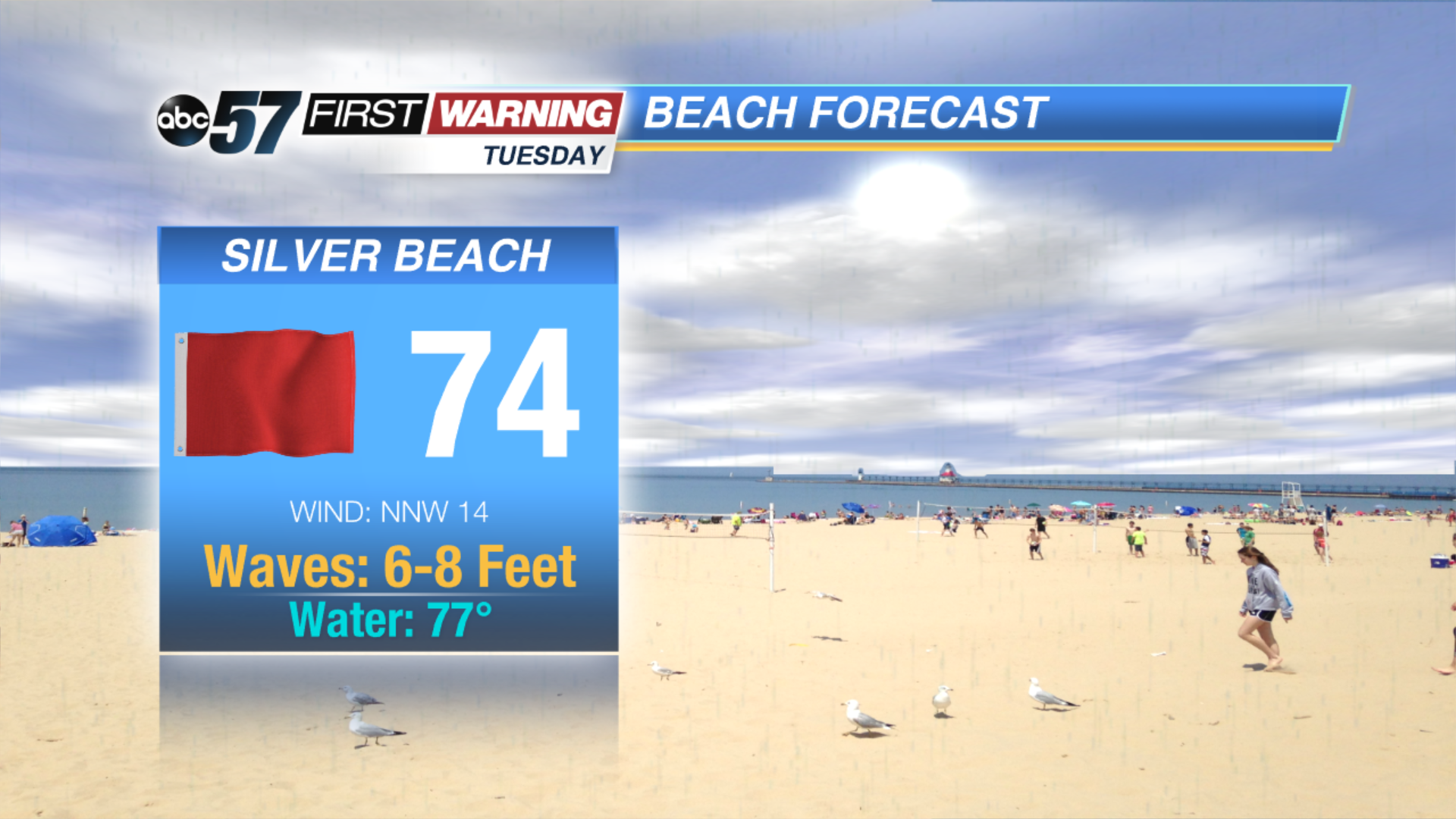
Scattered showers and storms Monday evening will bring the first round of rain and a low probability of severe weather. There’s a lull between rounds of rain this evening and widespread heavy rain Tuesday morning.
Tuesday will start with widespread rain, then gradually clear the rest of the day. A northwest breeze, gusting up to 25 mph will drop the humidity and cause large waves on Lake Michigan. The midweek will be very mild for August with highs in the mid-70s before muggy weather returns for the weekend.
Tonight: Showers and storms, low 68.
Tuesday: Rainy early then slowly clearing. High of 76.
Wednesday: Mostly sunny, high of 74.
Thursday: Sunny, high of 76.
Sign up for the ABC 57 Newsletter