Showers and storms still possible for Michiana this afternoon and evening


A stray shower or two is possible this morning, but overall quiet weather will stick around until this afternoon. Around 3pm thunderstorms will begin moving into our western Michiana counties. Overall trends this morning show everyone has the chance to see storm activity here in Michiana. Any storm that does develop this afternoon will have strong to severe potential. Severe threats include; damaging wind gusts up to 75+mph, large hail, heavy downpours, and isolated tornadoes. Storm activity will linger into the evening for most, but another round can’t be ruled out again closer to midnight for portions of southwest Michigan. After the storms roll through, then heat becomes a big concern for Tuesday and Wednesday. High temperatures will top out in the upper 90s to potentially 100. The heat index will range from 105-110. Make sure to limit time outside and stay hydrated. Thursday afternoon temperatures will fall back into the lower 90s with a chance for a few afternoon thunderstorms. We will keep dropping temperatures into the low to mid 80s heading into the weekend.
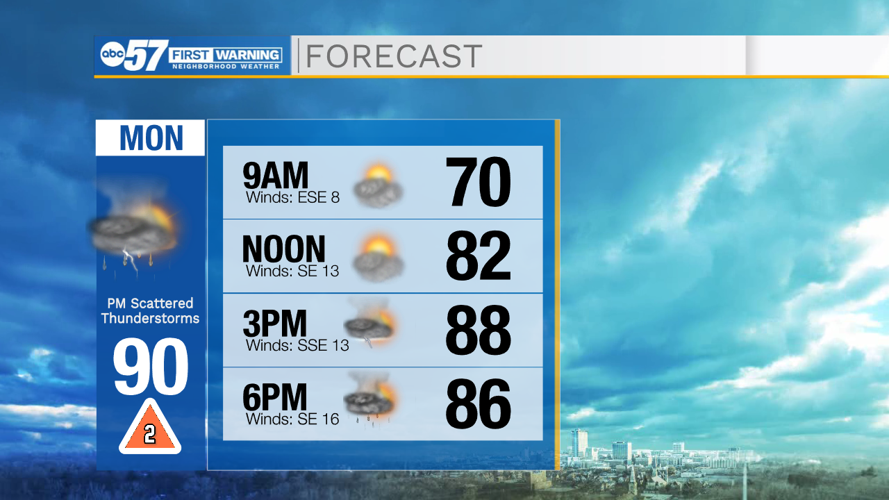
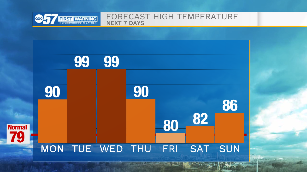
Today: PM Strong to severe storms. High 90.
Tonight: Mostly clear. Low 74.
Tuesday: Extreme heat. High 99.
Wednesday: Extreme heat. High 99.