


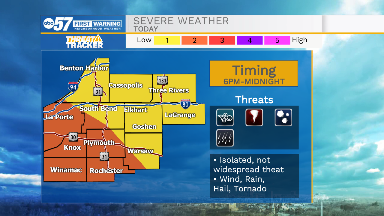
Showers and storms will form to our west and move east through the evening hours. A few of these storms could be on the strong to severe side with the main threat being damaging winds and large hail. There is a low tornado threat that we are watching closely. Storms will primarily impact Michiana from 6pm-Midnight. After midnight a few lingering showers will stick around, but all rain should clear by mid-morning tomorrow. Dry weather is in the forecast for Sunday with high temperatures reaching into the mid 60s. Monday looks mostly dry, but then rain showers work their way back into Michiana for late Monday evening. That round of showers and storms will stick around through most of Tuesday. Yet again, another system will pay us a visit on Thursday bring more rain chances that will linger into Friday. High temperatures this week will hold in the mid 60s through Tuesday, 50s on Wednesday, then back to the 60s heading into next weekend.
Tonight: Thunderstorms. Low 54
Tomorrow: Partly/mostly cloudy. High 64.
Monday: Mostly cloudy. High 64.
Tuesday: Scattered showers. High 66.