
-
3:53

’Beetlejuice’ takes the Morris stage over the weekend
-
1:25

Mild for now, Rainy Father’s Day
-
1:59

Madison Lifestyle District Development construction is underway
-
1:45

Latest rain reports, Much quieter today
-
0:52

Benton Harbor moving forward with Buss Avenue property renovations
-
1:38

Community tornado shelters open in rural counties ahead of storm...
-
2:21

Microsoft breaks ground on new Data Center in La Porte, Indiana
-
3:43

Demolition underway to make room for Colfax Corner development
-
5:20

CARE University helping support college students day to day
-
5:34

Suspect dead after officer-involved shooting on South Bend’s...
-
1:45

The rain and storm threat clear this evening
-
2:32

Some optimism that the risk for severe weather is slightly decreasing

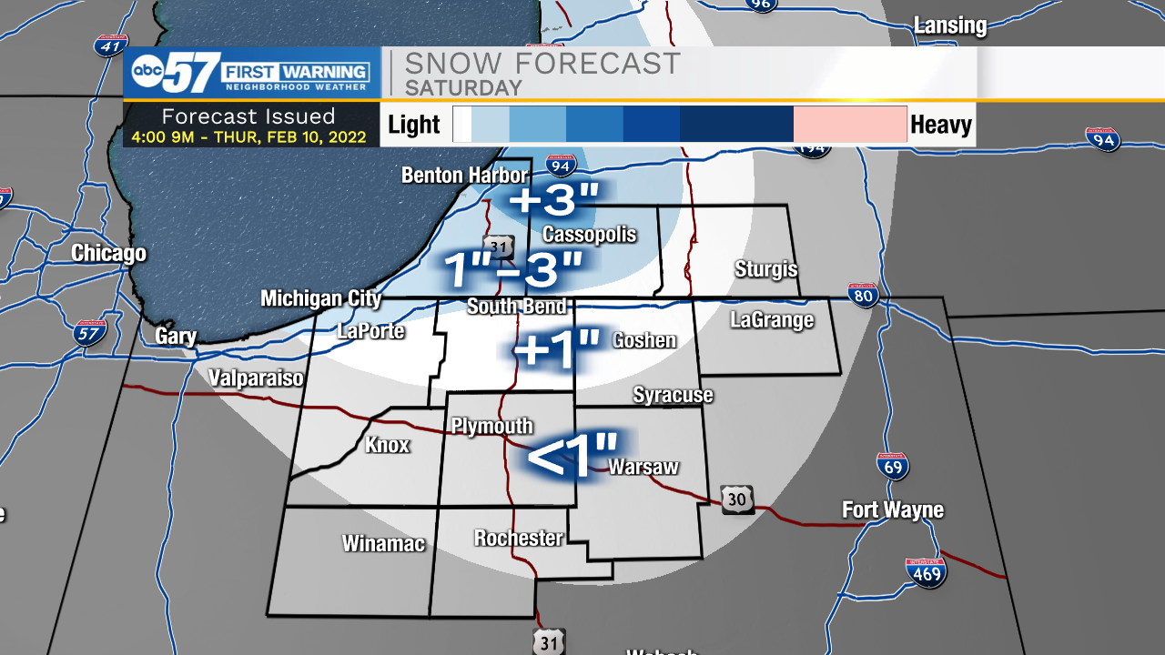
Friday starts with a mix or rain/snow, changing to all rain as temperatures warm to 40 Friday afternoon. There is a break in precipitation Friday afternoon, but as temperatures fall Friday night, lake effect snow showers are likely, with a couple inches in the snow belt. The weekend is cold. Next week a warm-up near 50 is possible, with rain.
Tonight: Breezy. Rain/snow late. Low 26.
Friday: Breezy. Rain/snow changing to all rain. High 40.
Saturday: AM snow showers. Mostly cloudy and cold. High 22.
Sunday: Partly cloudy and cold. High 22.
Sign up for the ABC 57 Newsletter