
-
3:37

Law enforcement, veterans and more participate in Back the Blue...
-
3:47

Families honor lost loved ones as lifeguards return to South...
-
1:16

No shortage of sunshine today
-
1:37

Memorial Day parade forecast
-
4:51

Local band ’The Erly’ stops by ABC57 ahead of June 3 performance
-
1:17

VERY foggy first few hours of the morning
-
1:57

A local taste brings New Carlisle community together on race...
-
0:45

Pancakes help raise funds to support the Alzheimer’s Association
-
1:03

Lighter rain expected into the afternoon
-
1:04

Non-severe storms expected
-
1:16

Showers start this morning
-
1:59

Mac & Cheese festival turns Four Winds Field into a kitchen

Light snow continues overnight into Wednesday morning. Additional accumulation of around one inch possible across Southwest Michigan, flurries in Northern Indiana.
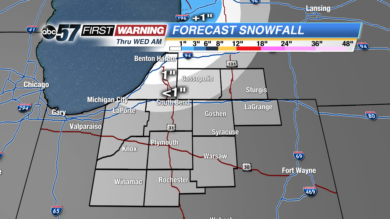
Temperatures slowly warm the rest of the week, highs rise from the mid-twenties Wednesday, to near 40 by Friday. An early spring storm will bring rain and wind Saturday night into Sunday morning, gusts could top 40 mph. Temperatures continue to moderate next week, fluctuating between the 30s and 40s.
Today: Mostly cloudy, lake effect snow showers, high of 19. Breezy.
Tonight: Mostly cloudy, lake effect snow showers, low of 10.
Wednesday: Partly to mostly sunny, high of 26.
Thursday: Partly cloudy, chance evening snow, high of 30.
Sign up for the ABC 57 Newsletter