Snow albedo: a science topic you might already know without realizing


The high albedo of fresh snow on the ground can keep us from warming. You might be thinking, "hold up there, Miss Meteorologist, that's a fancy word, 'albedo'." Would you be surprised to find out that you might already understand this topic without realizing it?
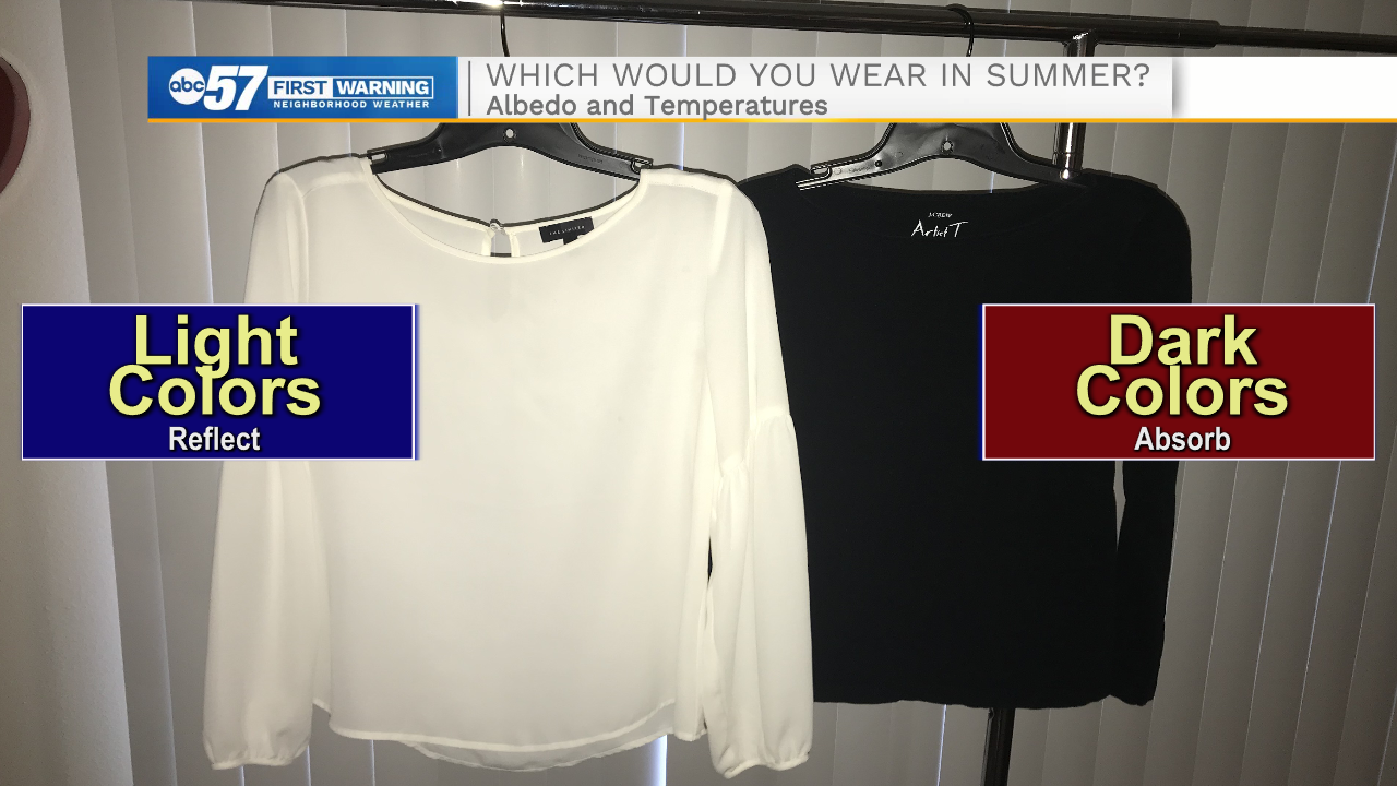
Here is an example using every day items. If both of these shirts were made from the same fabric, which would you pick to wear on a hot summer day?
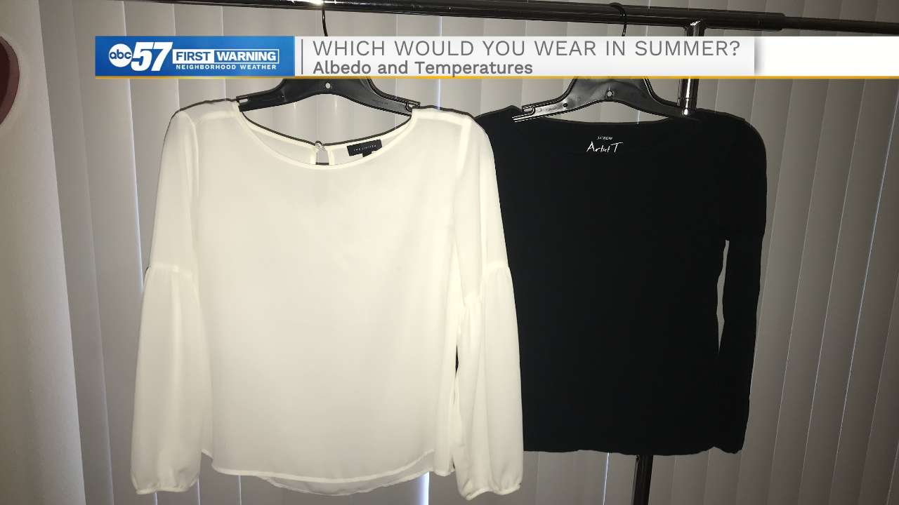
It would make sense to pick the white shirt. We all know the feeling (read: pain) of wearing a black shirt and feeling sticky. Why does this happen?
Light colors (especially white) reflect light. When sunlight hits the white shirt, most of it bounces right back off. Darker colors (like the black shirt) are better at absorbing. When you stand in direct sunlight in a black shirt, you're going to heat up pretty quickly.
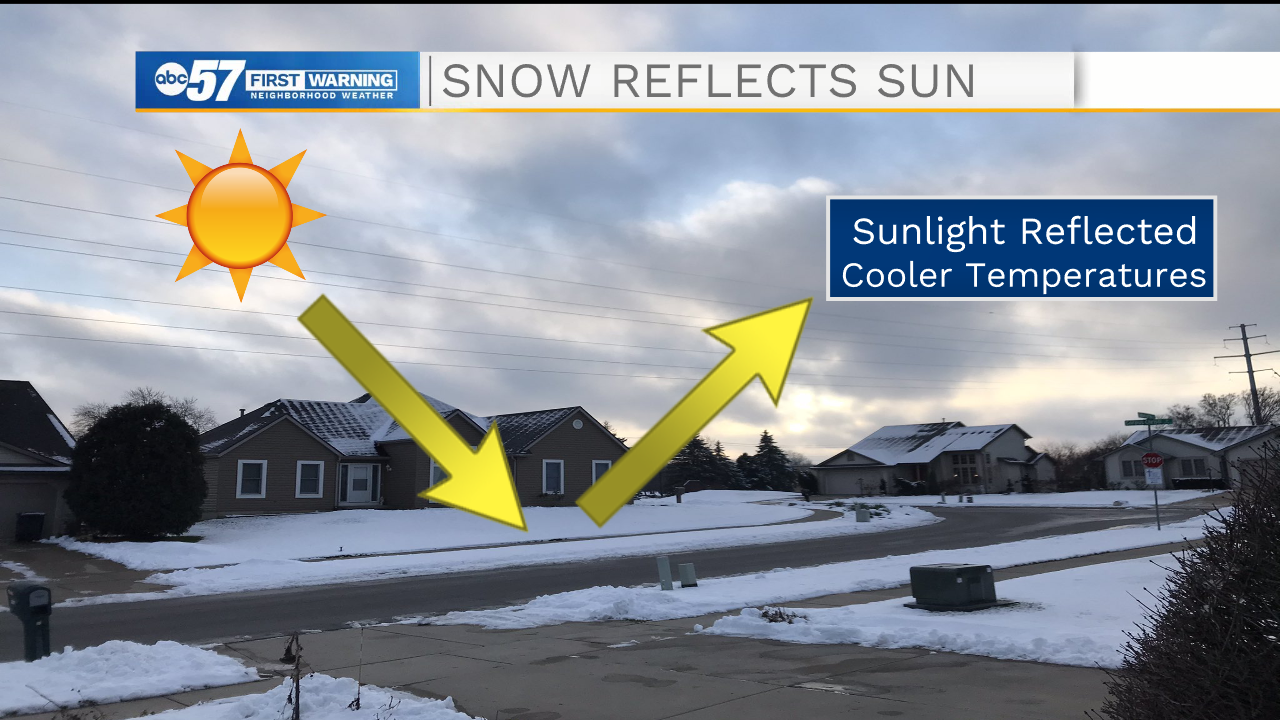
Knowing this, let's apply it to Earth. When the ground is covered by fresh snow (nearly pure white), the sun shining down will be reflected back into the atmosphere. The surface temperatures will end up cooler.
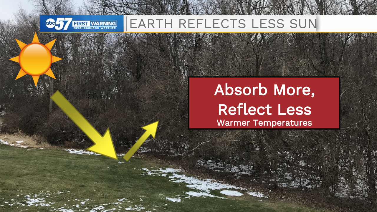
Right now, your backyard probably looks more like this: a few pockets of old snow (not as pure white), wet dirt, and green grass. These colors are darker than pure white snow. They are better at absorbing (just like the black shirt) sunlight. More of the heat stays at the surface instead of going back into the atmosphere. When the ground looks like this, we end up with warmer temperatures for the day.
Just for reference (this is the nerdy paragraph you can skip if you want), albedo is measured as a fraction of how much light is reflected. A high albedo (numbers closer to one) means more reflection. Fresh snow can have albedo as high as 0.8 or 0.9, while old snow has a lower albedo, around 0.4. Typical grass has an albedo around 0.2 to 0.3. Meteorologists can use these numbers in many calculations, and maybe it will be a useful piece of trivia for you someday.
Make sense? See, you're becoming a scientist already! Think we can apply the albedo concept to anything else?
Let's look at an example Skew-T chart. Meteorologists also use these in putting together their forecasts. The red line is temperature measurements, starting from the ground then up higher into the atmosphere. Typically, temperature should be warmer at the surface and get cooler as you go higher into the atmosphere above Earth.
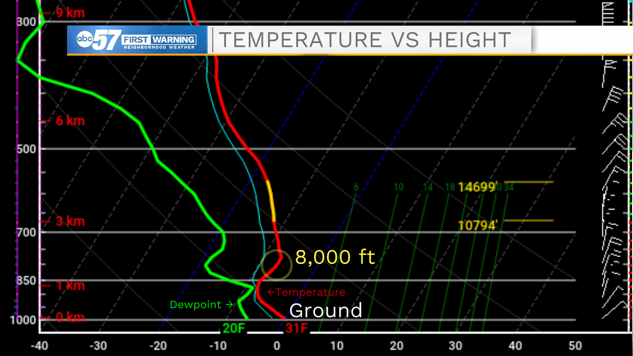
Recently, we've had a temperature inversion above Michiana. Instead of getting cooler, temperatures are warmer above us. That means we are stuck with cool air right here in Michiana. This is the circled area, around 8,000 feet on the chart.
Let's bring our friend albedo back into this. We just learned we can't warm up much at the surface when snow is on the ground. With a warm layer up above us, the cold air essentially gets trapped. It's like there's an invisible lid up in the atmosphere that keeps cool air from escaping.
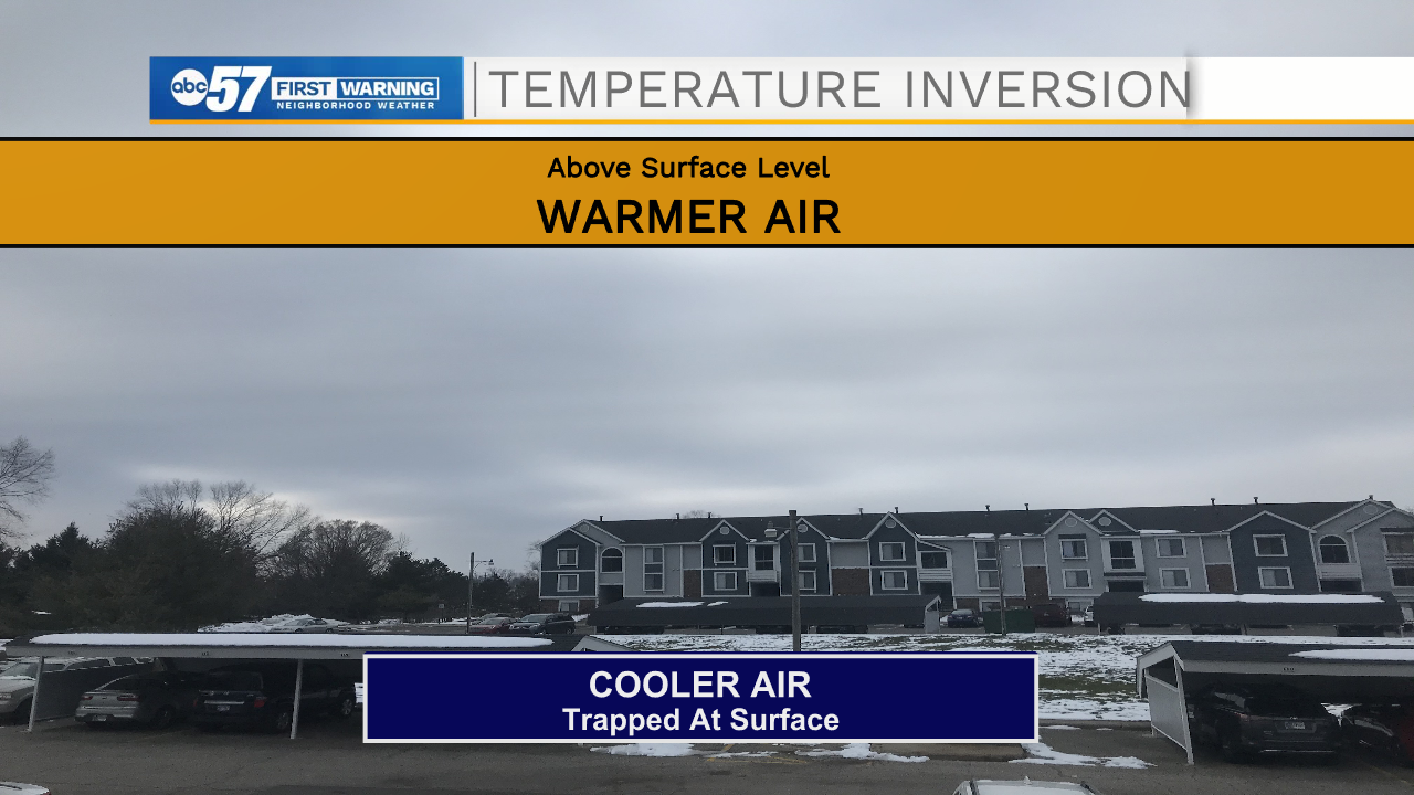
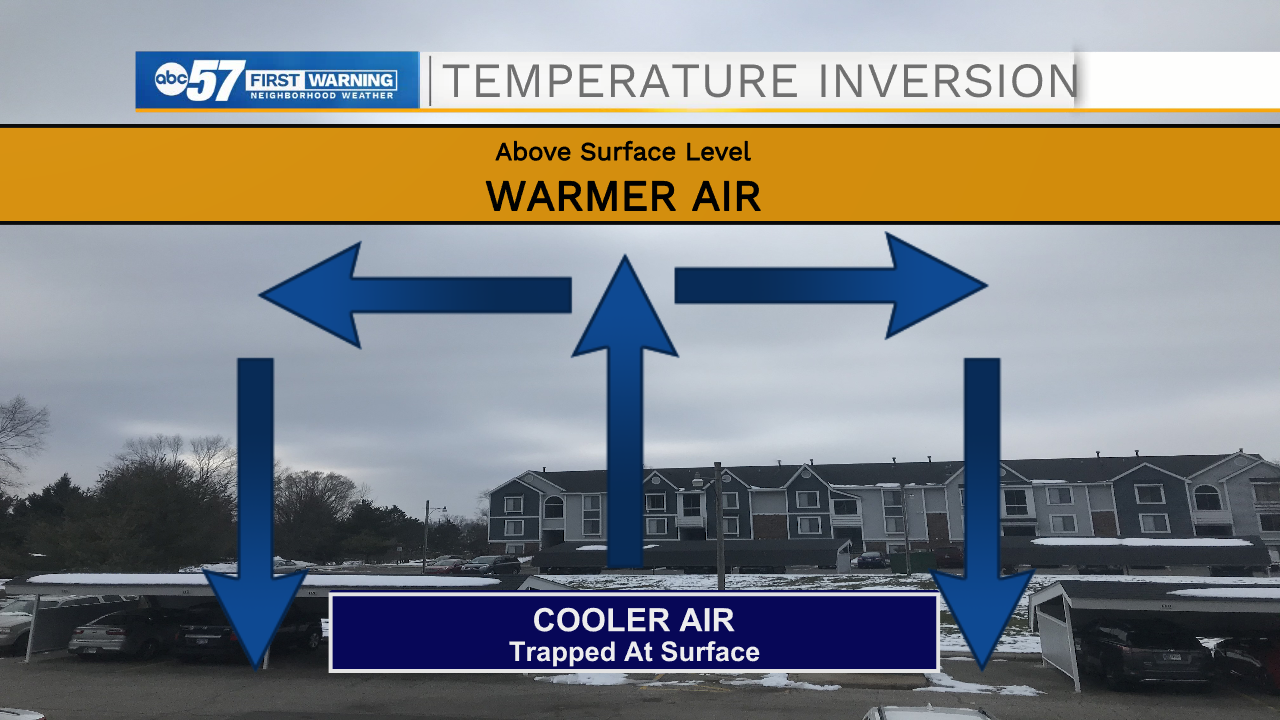
Along with cool air, we can also get stuck in a pattern with lots of clouds and fog with a temperature inversion. How do we get out of this pattern? Once the snow starts to melt, remember, the ground is able to absorb more energy from the sun. That's when we see some of the clouds breaking up, too, and the inversion stops.
Taking everything you just learned, let's look at the forecast today. Snow is mostly melted outdoors right now, and we have a high around 42 degrees. A few clouds could start breaking up enough to give us a little peek of sunshine. Wow! The science makes sense! Enjoy the mild day, because by the weekend with more snow, now you know too that it'll likely get cooler again.