


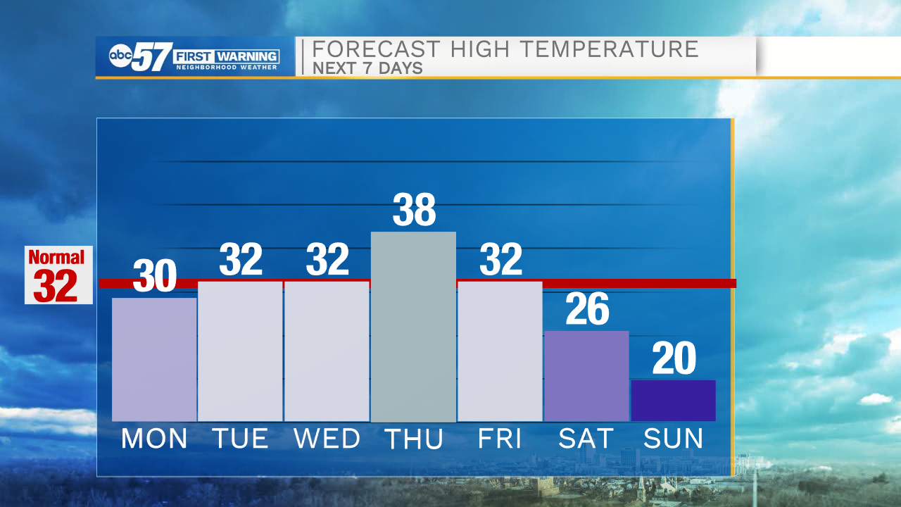
Snow showers will continue into the evening hours, with clearing expected just before midnight. A few isolated flurries could linger into Monday morning. Temperatures tomorrow morning will be in the lower 20s under cloudy skies. We will stay dry tomorrow, but then lake effect snow showers become possible again into Tuesday. This round of snow will stay west into LaPorte and Starke counties with little accumulation expected. Dry weather will return for Wednesday with high temperatures toping out in the lower 30s. Thursday morning a few snow showers are possible, but then temperatures warm into the upper 30s turning snow over to rain. Rain showers will then switch back over to snow into Friday as temperatures drop into the 20s. Snow showers will linger into the weekend. Next weekend a big surge of cold air moves into Michiana dropping highs into the low 20s and lows into the teens. This cold air will stick around into the beginning part of the following week.
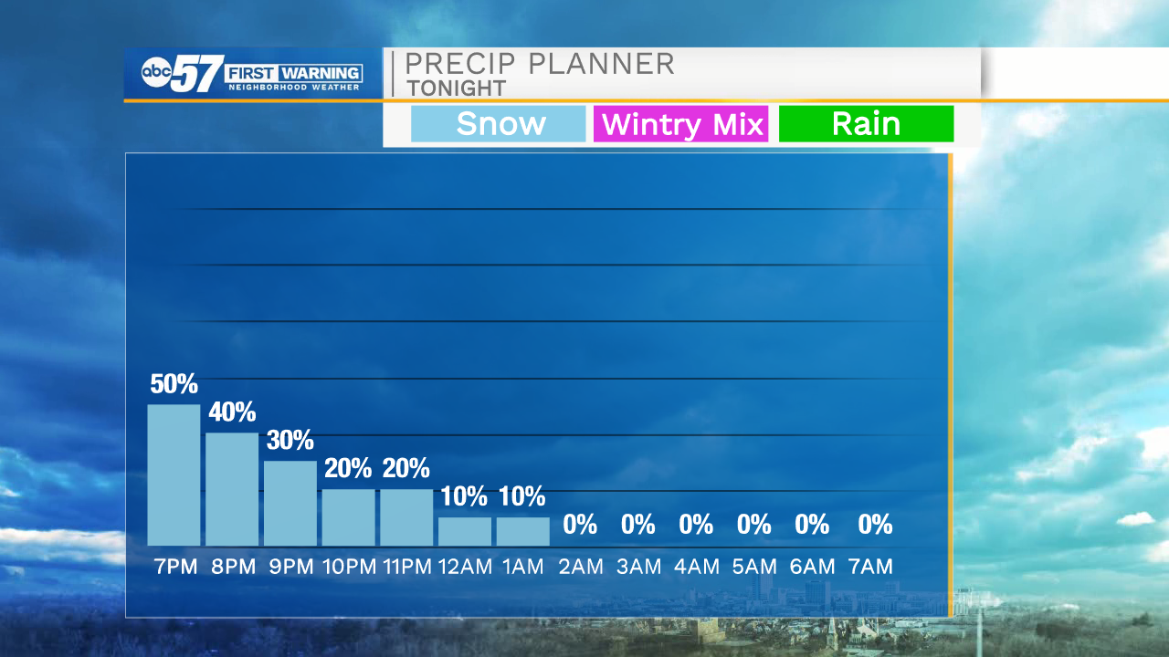
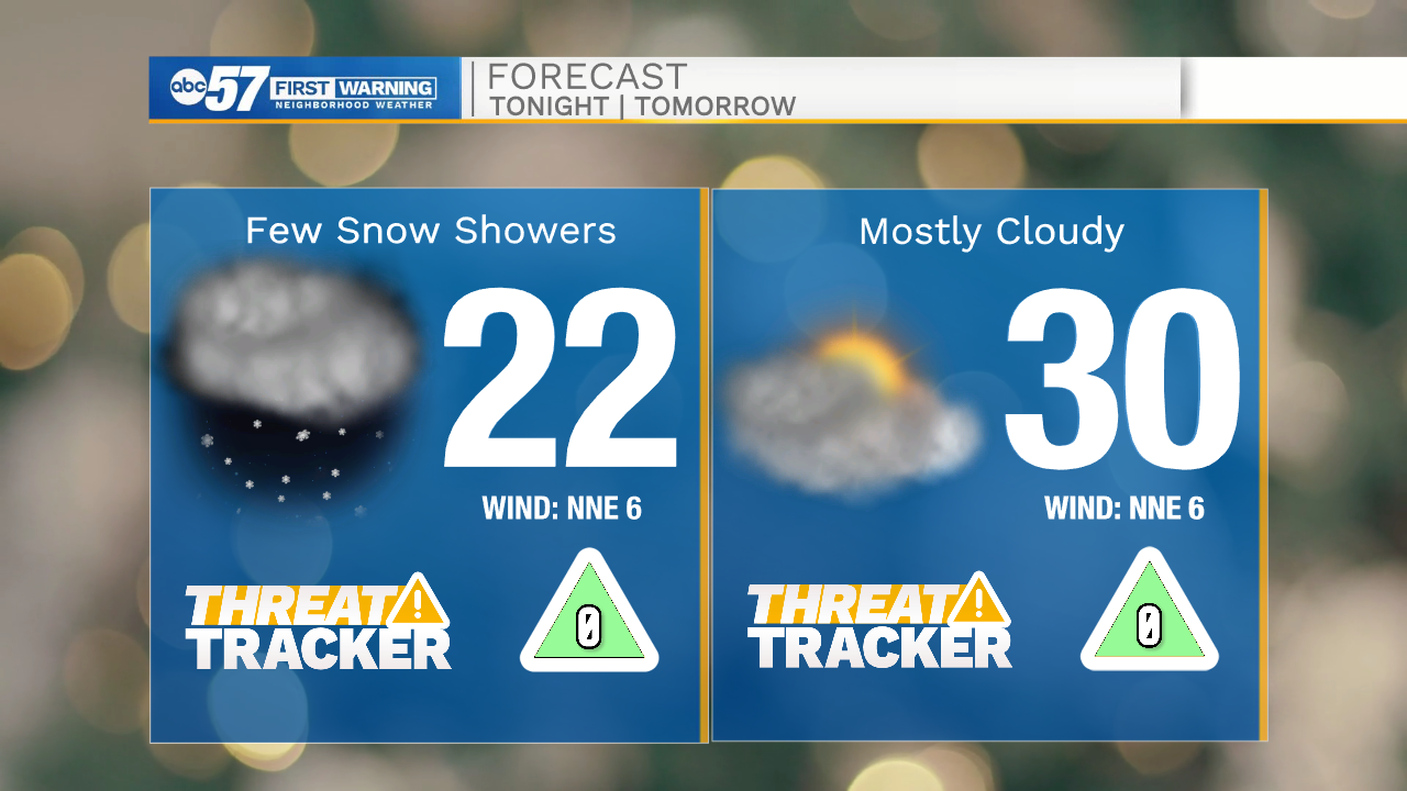
Tonight: Isolated snow showers/flurries. Low 22.
Tomorrow: Mostly cloudy. High 30.
Tuesday: Partly cloudy/ Snow showers west. High 32.
Wednesday: Partly cloudy. High 32.