
-
2:00

Annual Studebaker car show takes over Ironwood Plaza
-
0:55

Beautiful weekend expected
-
1:05

Truly wonderful conditions
-
0:41

One person left with serious injuries after high-speed pursuit...
-
2:15

Fort Wayne Tin Caps put an end to the SB Cubs winning streak
-
1:21

This weekend is the annual Hall of Heroes Comic Con
-
0:46

Elkhart Police Department respond to shots fired call at the...
-
3:55

ABC57 speaks with Cass County Commissioners, Judge and Interim...
-
2:48

Common Council to consider appeal options following South Bend...
-
0:52

South Bend seniors explore local parks, event centers, and available...
-
1:51

Mentone Egg Fest celebrates 80th year
-
4:58

New reactions after Notre Dame releases findings of priest sex...

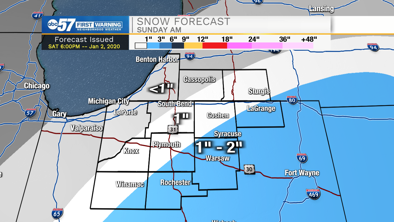
Light rain showers look to develop later this evening. The rain will turn over to snow during the early morning tomorrow. Snow accumulation will be around 1-2 inches for our far southern counties. A dusting to an inch is possible for the rest of the Michiana area. Expect a few slick spots on the roadways tomorrow morning. High temperatures during the afternoon will top out in the mid 30s. Dry weather is in the forecast for Monday and Tuesday, but then snow chances return on Wednesday. High temperatures this week will remain steady in the mid to upper 30s.
Tonight: Snow showers. Low 30.
Tomorrow: Snow showers. High 36.
Monday: Mostly cloudy. High 38.
Tuesday: Partly cloudy. High 38.
Sign up for the ABC 57 Newsletter