Snow & wind to impact Michiana today


Snow continues for the MI counties early this morning, but everyone will get in on the action by sunrise. Moderate to heavy snow is likely during the mid-morning, but will taper down in the afternoon before wrapping up this evening. The northern half of Michiana is under a Winter Storm Warning until 2 PM, while the southern half’s doesn’t expire until 7 PM. Gusts of 30-35 MPH will produce whiteout conditions at times today so regardless of totals, travel will be very difficult. Totals still around 3-6” for most of us, with the best chance for 6+” for the northern tip of Michiana.
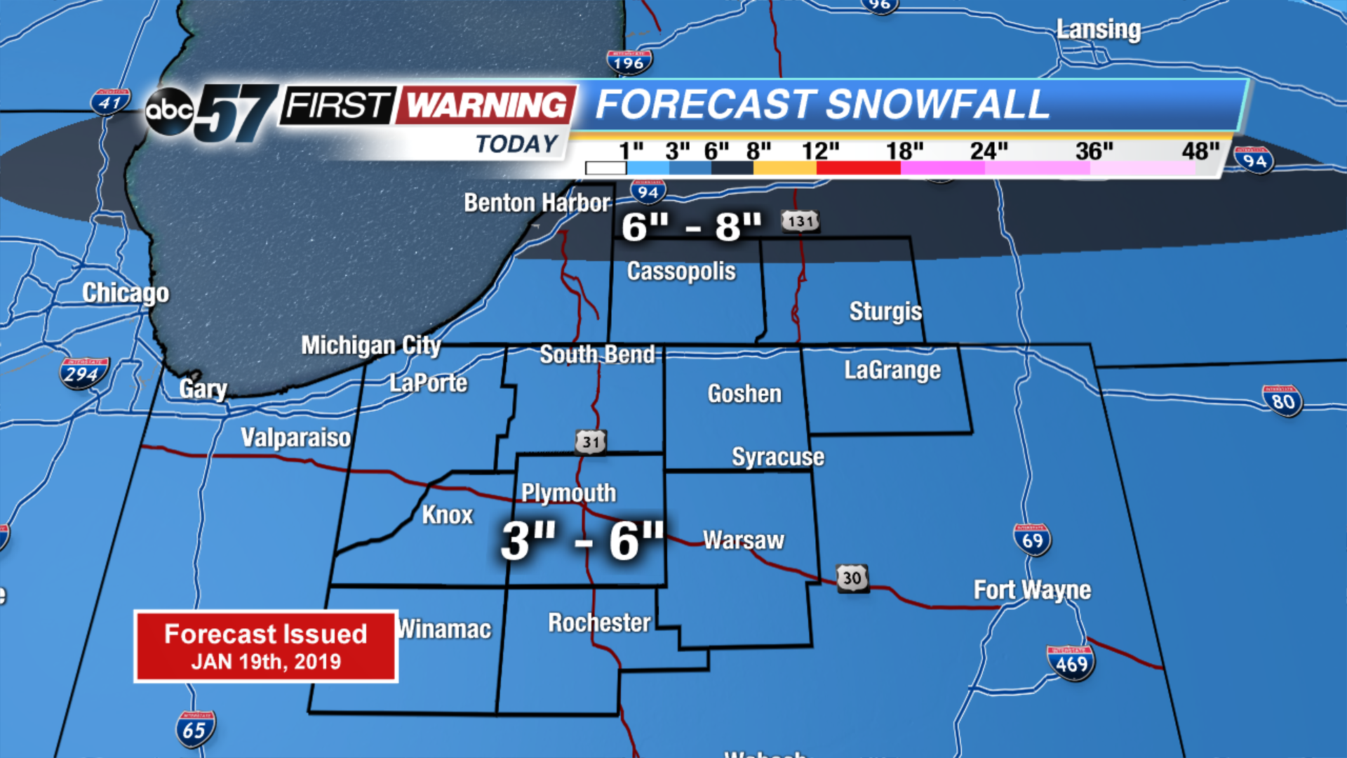 Updated snowfall totals by the end of Saturday
Afterwards, temps drop like a rock into the low teens for highs with lows near or below zero Sunday and Monday. The pattern stays active as well with PM lake effect possible tomorrow and another round of rain/snow Tuesday into Wednesday.
Today: Cloudy with snow and blowing snow. Could be heavy at times. High of 24.
Tonight: Mostly cloudy with snow ending. Mostly clear by sunrise. Breezy. Low of 8.
Sunday: Mostly sunny to partly sunny with a chance of PM L.E. snow. High of 14.
Monday: Mostly sunny to partly sunny. High of 12.