Snowy and extreme cold pattern sticks around through next week

-
2:20

Tracking severe weather through the mid-afternoon
-
3:17

Applications open for Fall Citizens Police Academy in South Bend
-
2:23

Elkhart County 4H Fair food vendors celebrate 50th year of business
-
2:16

Young football athletes learn about protecting their bodies,...
-
1:24

Storm track timing could be shifting
-
0:57

Unity Gardens brings music, food, and crafts for Westside BBQ...
-
1:50

Quiet evening, Storms after Midnight
-
0:57

Deer Creek Hunt Club throws a skeet shoot event for Deputy Jon...
-
1:44

Two rounds of storms Monday
-
1:07

Mini heat wave starts out the door
-
2:23

La Porte community rallies for Sammy Strong Benefit, raising...
-
1:57

The Potawatomi Zoo opens its gates to Zoo Nights Live

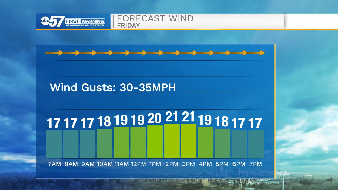
Temperatures this morning continue to drop into the teens with wind chills nearing the negatives. Road conditions this morning are very slick due to ice and snow pack. We are also tracking gusty winds into the 30-40mph range. Winds look to stay on the stronger side into the afternoon. High temperatures today will only top out in the upper teens. Another round of snow moves into Michiana Saturday evening, bringing chances for a few additional inches of snow in some areas. The snow and cold pattern will continue into next week. Low temperatures will mostly stay in the single digits with high temperatures in the teens.
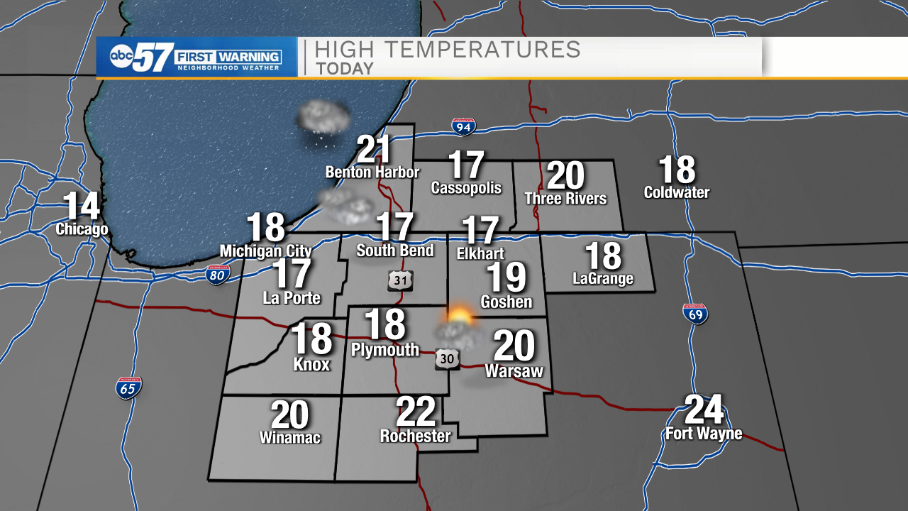
Today: Cloudy and breezy. High 17.
Tonight: Cloudy. Low 8.
Tomorrow: Evening snow showers. High 15.
Sunday: Snow showers. High 12.