Snowy Saturday, first major snow of the season


Snowy Saturday, a quick round of system snow will bring widespread accumulation of one to three inches to the area. Lake effect bands will then ramp up for the rest of the day. An additional three to six inches is expected in lake effect zones through Saturday night. This is a long event so snow won’t pile up all at once but continue to add up and cause slick roads and low visibility under the bands.
Sunday there will be a break from the snow before we get back into the snowy pattern starting Monday and lasting through the middle of next week.
Tonight: Snow starting late, low 25. 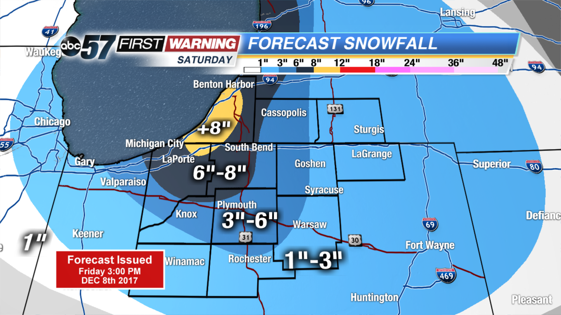 Highest snow totals through La Porte, Berrien and St. Joseph Co
Saturday: Snowy and breezy, high of 30.
Sunday: Partly cloudy, high 30.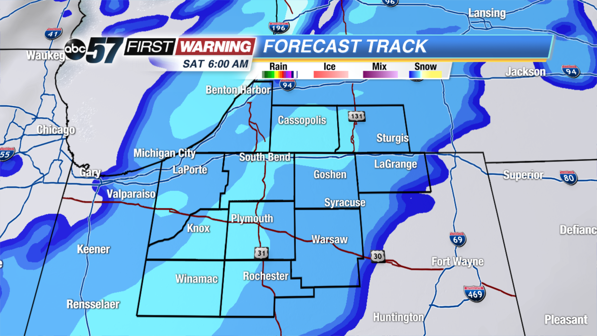 Widespread system snow Saturday morning
Monday: Mostly cloudy, chance of snow, highs in the mid-30s. Bans of lake effect snow last through Saturday afternoon