
-
1:46

A chilly and calm start to the weekend
-
1:00

NIPSCO workers rally in South Bend for new contract
-
1:53

Severe weather threat is over, MUCH colder Friday
-
3:43

South Bend Mayor James Mueller delivers 2026 State of the City...
-
0:52

Family and friends of Adrian Cruz voice frustration in sentencing...
-
2:13

Potawatomi Zoo prepares for opening day with new attractions
-
2:54

Local expert weighs in on landmark social media trials
-
1:33

Round one of storms moving east, Round two arriving soon
-
2:38

Bourbon residents recall tornado as severe weather strikes again
-
1:34

Tornado threat decreasing, but severe weather still expected...
-
1:42

Damaging winds and hail move in this evening
-
2:51

Severe weather expected in Michiana later today

Snow squalls intensify after midnight, accumulation of more than three inches is possible in parts of Berrien, La Porte and St. Joseph counties. Greatest concern will be slick roads for the morning drive Tuesday.
Snowy start to Tuesday, roads may be slick with a few inches on the ground and a coating of snow or slush on the roads. Snow showers wane a bit during the day as temperatures warm towards the freezing mark. Snow showers may bring an additional inch Tuesday night as temperatures fall back into the 20s. Sunshine and a slow warm-up are in store the rest of the week.
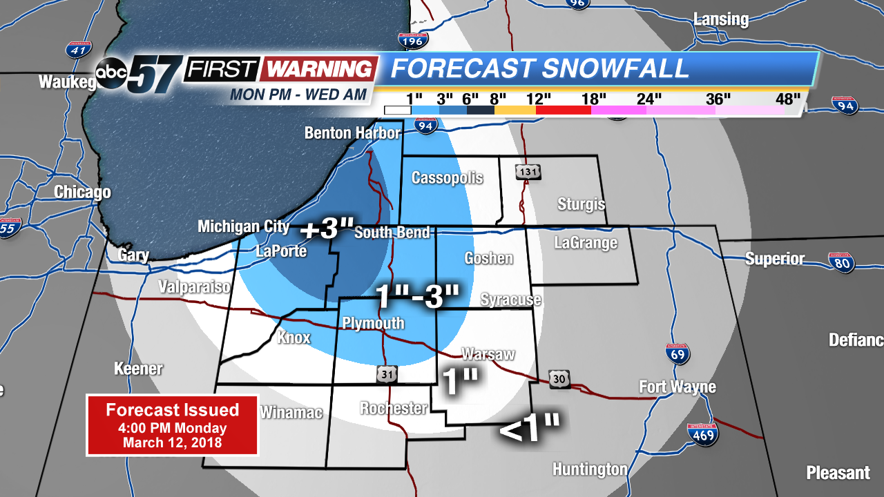
Tonight: Lake effect snow showers, low 26.
Tuesday: Lake effect snow showers, high of 32.
Wednesday: Morning snow showers, high of 38.
Thursday: Mostly sunny, highs in the low 40s.