Snowy Wednesday into Thursday and a drop in temperatures


Tuesday, February 11th, 2020
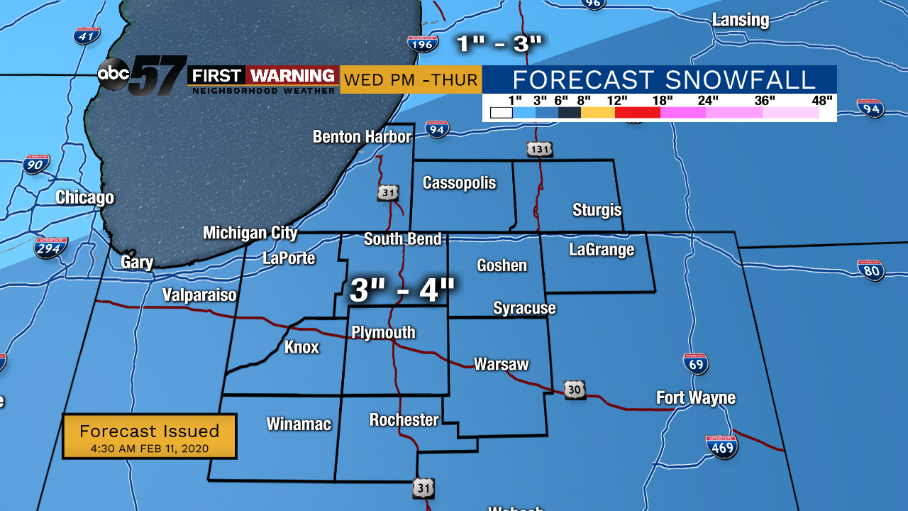
A nice mix of sun and clouds today! Clouds move back in on Wednesday ahead of system that will bring a wet snow starting after midday. It will last into Thursday morning with lake effect snow possible that afternoon. 3-4” of snow is expected for most with additional snowfall possible from lake effect snow. Temperatures crash behind this system, going from the upper 20s around midnight to the single digits by Friday morning. Temperatures do quickly rebound heading into the weekend with a chance of a wintry mix Saturday night.
Today: Partly cloudy. High 36.
Tonight: Mostly to partly cloudy. Low of 20.
Wednesday: Increasing cloud cover. Afternoon wintry mix, then evening snow. High 36.
Thursday: Cloudy and a few snow showers. Temperatures drop throughout day from 28 degrees.