
-
1:51

Try to beat the rain on Father’s Day
-
0:28

Mother killed, 2-year-old injured after being struck by vehicle...
-
1:00

A pleasant day for Juneteenth
-
3:42

Family of 24-year-old Timothy Johnson killed in Cass County hold...
-
2:24

Sun shines on Elkhart Jazz Fest
-
2:33

Juneteenth celebration kicks off Elkhart Jazz Fest
-
0:34

New county park in Kosciusko
-
2:10

Meet Andy Stephenson, Goshen’s new Chief of Police
-
3:53

’Beetlejuice’ takes the Morris stage over the weekend
-
1:25

Mild for now, Rainy Father’s Day
-
1:59

Madison Lifestyle District Development construction is underway
-
1:45

Latest rain reports, Much quieter today

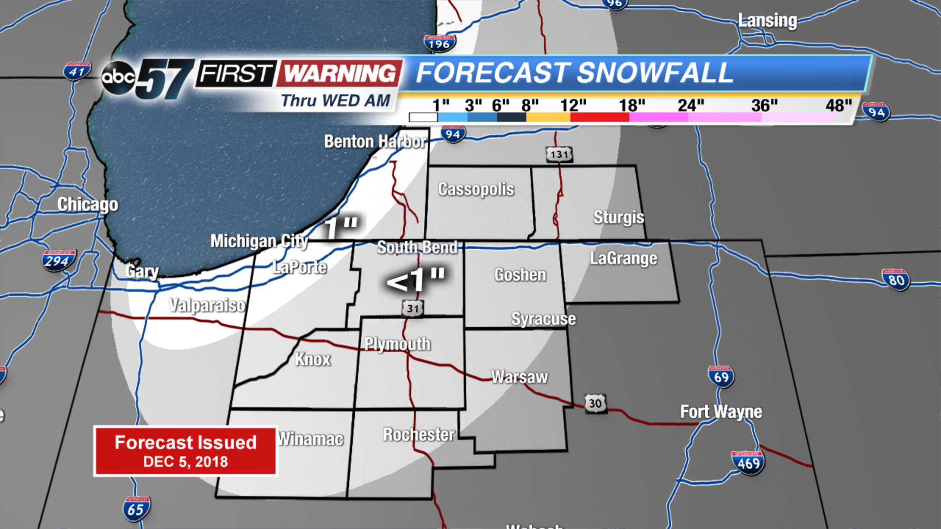
Light lake effect snow showers start Wednesday, up to an inch of accumulation is possible. The wind changes direction ahead of cold front but temperatures do little warming. Light snow is likely again Thursday morning, early estimates still on the order of around one inch. Major change to end the week, the forecast is still cold but sunshine looks to dominate the forecast through the weekend. Next week trends milder.
Tonight: Mostly cloudy with a chance of lake effect snow showers. Low of 24.
Wednesday: Mostly cloudy with lake effect ending early, then partly sunny. High of 32.
Thursday: Light snow early, mostly cloudy and breezy. High of 32.
Friday: Partly cloudy, high of 28.
Sign up for the ABC 57 Newsletter