
-
2:23

Elkhart County 4H Fair food vendors celebrate 50th year of business
-
2:16

Young football athletes learn about protecting their bodies,...
-
1:24

Storm track timing could be shifting
-
0:57

The Unity Gardens brought music, food, and crafts for their Westside...
-
1:50

Quiet evening, Storms after Midnight
-
0:57

Deer Creek Hunt Club throws a skeet shoot event for Deputy Jon...
-
1:44

Two rounds of storms Monday
-
1:07

Mini heat wave starts out the door
-
2:23

La Porte community rallies for Sammy Strong Benefit, raising...
-
1:57

The Potawatomi Zoo opens its gates to Zoo Nights Live
-
2:50

Carson Kvapil wins his first O’Reilly Auto Parts Series win...
-
1:10

William Tuffs honored as the only Indiana man who took part of...

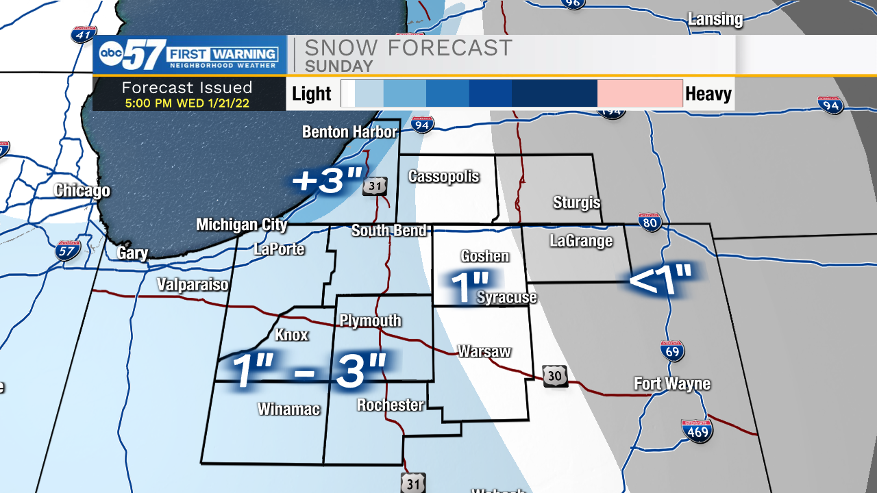
The cold continues through the weekend. Saturday is mostly cloudy with a flurry possible. Sunday morning, the first of two clippers rushes through the area, a quick inch of snow is possible before noon. Monday another clipper hits later in the day, this could bring more widespread snowfall, with the potential for a few inches, but nothing extremely heavy. Tuesday, lake effect snow could ramp-up but those details are still too far out to forecast. The middle of next week is bitter cold.
Tonight: Mostly clear. Low 14.
Saturday: Morning flurries, mostly cloudy. High 28.
Sunday: Light AM snow showers. High 24.
Monday: PM snow showers. High 32.
Sign up for the ABC 57 Newsletter