
-
2:54

Eligible 17-Year-Old Voters mistakenly rejected for Primary Voting
-
1:28

Starke County Prosecutor race heats up ahead of primary
-
2:02

Here’s what’s leading to higher gas prices plus when they...
-
3:10

Prayers pouring in for Michiana basketball coach fighting for...
-
1:54

Marshall County prosecutor candidates outline ’immediate fixes’...
-
4:48

Crops in Crisis?
-
1:32

Severe storms possible tonight
-
1:32
Severe storms possible tonight
-
2:27

What you need to know ahead of casting your vote
-
0:58

Sunshine today to storms tonight
-
2:02

Climbers scale walls one last time at Apex Climbing Gym Sunday
-
2:14

Dance like Nobody’s Watching: Logan Center hosts third Annual...

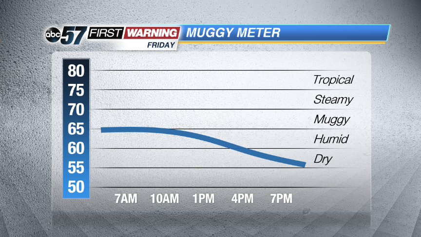 The humidity drops sharply Friday
Very muggy overnight into early Friday. Showers and storms increase in coverage becoming widespread after midnight and lasting through Friday morning. Storms are likely to be loud with thunder, heavy rain and possibly gusty wind. Some storms could be severe.
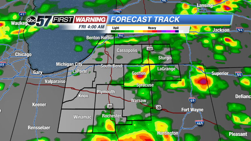 High resolution run of Forecast Track show storms coming together in the early morning Friday.
Morning showers and storms clear Friday and temperatures and the humidity drops. Skies will clear into Saturday and the weather will be unseasonably mild for the end of June. Highs will be in the low 70s through early next week before warming back into the 80s.
Tonight: Showers and storm likely, some could be strong, low of 68.
Friday: Morning showers and storms, then mostly to partly cloudy, high 76.
Saturday: Mostly sunny, high 74.
Sunday: Partly cloudy, highs in the low 70s.
Sign up for the ABC 57 Newsletter