Storms overnight could be strong to severe

-
1:27

Community Build underway at Kathryn Park
-
2:34

Day two of searching for a missing child continues
-
3:47

The Elkhart community is searching for answers after a 2-year-old...
-
1:04

Overall pleasant for Michiana
-
1:52

South Bend Common Council issues an official apology to residents...
-
0:54

Slightly cool out the door
-
1:54

Suspect identified, charged in fatal hit-and-run of Timothy Johnson
-
0:39

Prairie Street Cemetery works to clear storm damage
-
1:36

Reaching out for support gives father a second chance in life
-
2:08

St. Joseph County police investigating Bypass incident from Saturday...
-
2:07

Color guard coach charged with Sexual Misconduct with a Minor
-
1:09

Pleasant for the rest of today

ABC57 First Warning Neighborhood Weather Forecast
Wednesday, July 28th, 2021
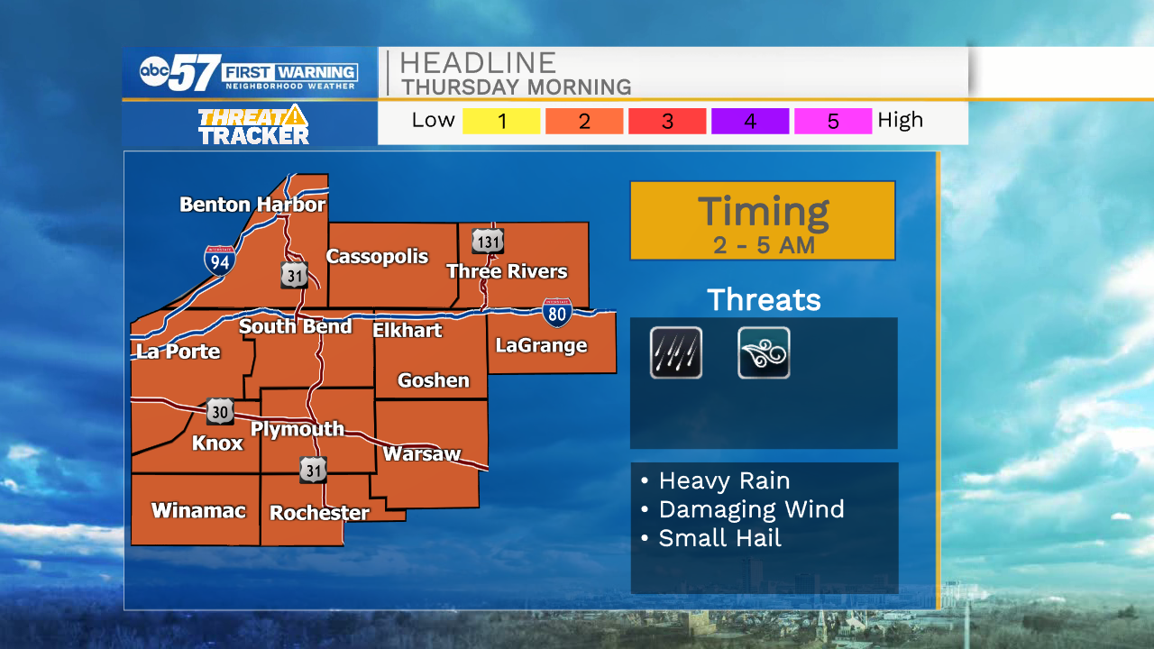
Today is our last hot and muggy day in this stretch. Tonight, storms move in between 2 to 4 AM. They could be strong or severe with greatest threats being straight-line wind and heavy rain. Non-severe scattered storms will continue into late Thursday morning as the cold front passes through. Clouds break up for Thursday evening.
Friday looks beautiful and comfortable as we only top out in the upper 70s. Despite a chance of rain Saturday night, the weekend looks nice too. A mix of sun and clouds with a high near 80.
Today: Mostly sunny. High 88.
Tonight: Scattered storms, possibly strong to severe. Low 72.
Thursday: AM showers/storms. High 82.
Friday: Partly cloudy. High 78.