
-
1:15

Cold and bleak weather to start off the day
-
3:49

Asking for Accountability: Michiana Elected Officials on on-going...
-
3:37

South Bend Cubs explain weekend washout
-
4:02

Early voting is underway as Indiana prepare for its May 5 primary...
-
3:27

Tax-related scams to watch out for
-
0:09

Crews repair weekend washout under Coloma train track
-
0:58

Chilly and sunny Tuesday ahead
-
0:41

Elkhart police investigating Monday night shooting
-
3:47

Elkhart Police Department accepting applications to Citizens...
-
0:52

A slight warm-up but chilly weather still dominates
-
1:09

Bitterly cold out the door
-
3:03

Looking to younger generations to keep Dyngus Day thriving

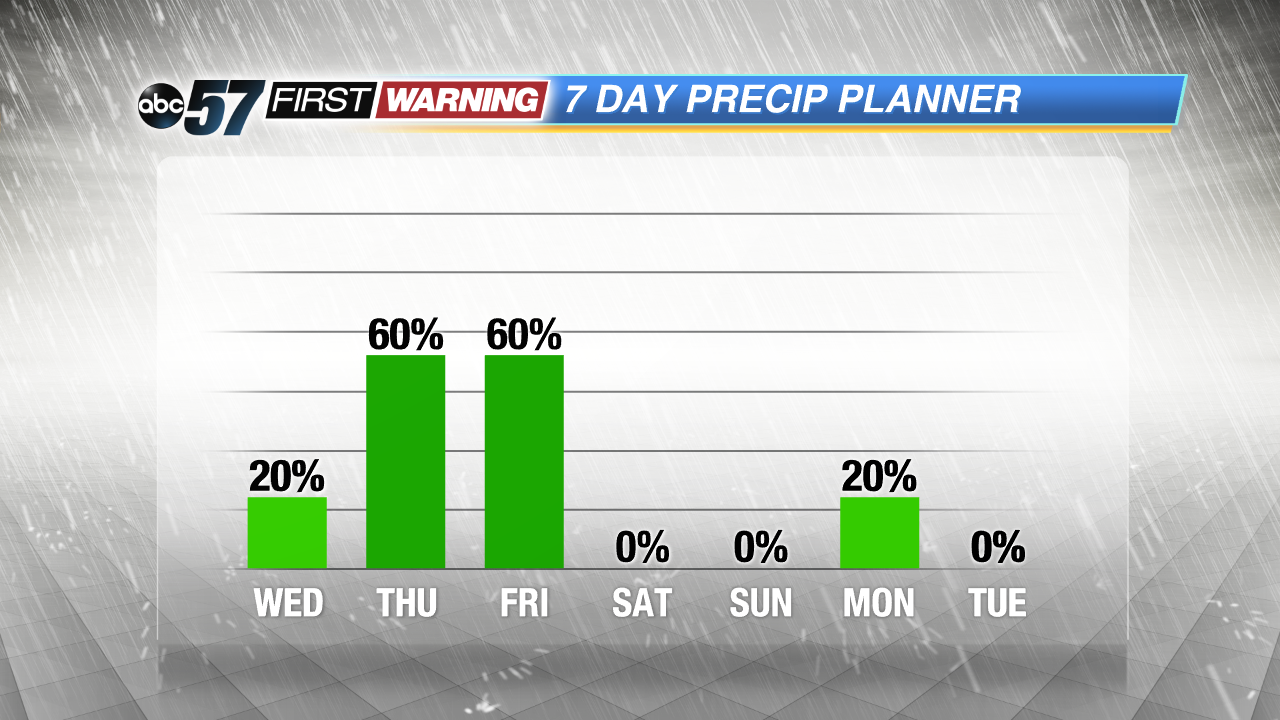 Thursday and Friday are the most likely days for rain.
Temperatures and the humidity are on the rise Wednesday, highs in the low 80s and the mugginess builds overnight. Storms are likely to end the week, Thursday and Friday. Heavy downpours and gusty wind are possible with these storms. The forecast is not a complete washout, however storms are possible anytime. The two main rounds looks to be Thursday morning and Friday midday. The weekend through the Fourth of July looks warm and dry.
Tonight: Clear and cooling, low of 54.
Wednesday: Mostly sunny turning partly sunny, high 80, storms late.
Thursday: Scattered storms, highs in the mid-80s.
Friday: Scattered storms, highs in the low 80s.
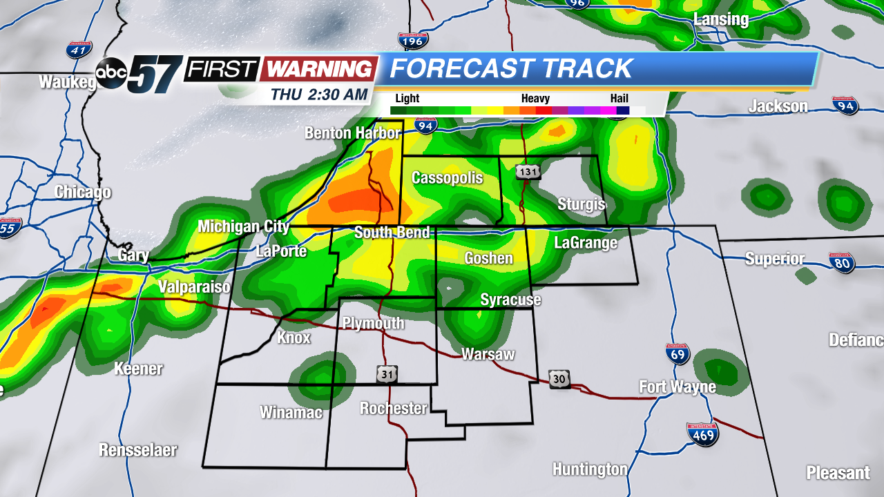 First round of storms hits early Thursday morning.
Sign up for the ABC 57 Newsletter