
-
0:46

Crowds gather for Fins and Feathers Fest at La Porte City Fairgrounds
-
0:46

Paramount School of Excellence hosts teacher fair
-
2:30

Voting advocacy, peaceful demonstrations and donations: South...
-
2:04

Warming to start the week, Showers and storms by Tuesday
-
2:10

Cool, but calm, today
-
1:23

City of South Bend presents an ’Age-Friendly Plan’ to better...
-
0:54

South Bend Venues Parks and Arts hosts ’Adult Recess’
-
2:27

Why Aneyas Williams turned down the transfer portal and stayed...
-
2:21

Bourbon community rallies around Triton boys’ basketball team...
-
5:02

Dave Matthews shares details about LLC bankruptcy filings
-
1:00

Warming up this weekend before more storms next week
-
1:46

A chilly and calm start to the weekend

A line of storms dives out of Wisconsin early Thursday morning and moves across Lake Michigan. The questions for Michiana are, will this be a direct hit or a glancing blow? Hot much will storms weaken, arriving most likely after 3:00 a.m. Every should prepare for the possibility of losing power Thursday morning.
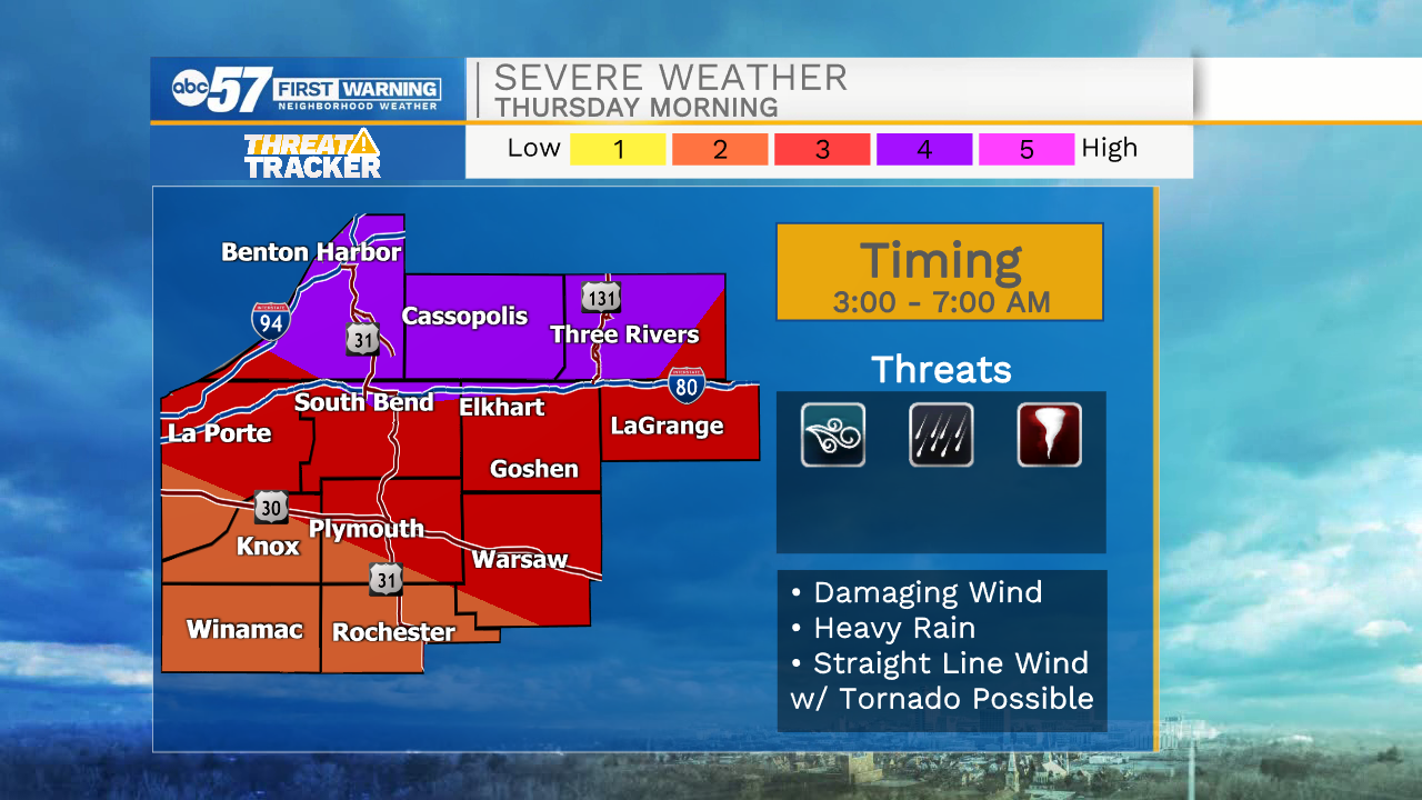
The line of storms clears quickly Thursday morning, the rest of the day will be dry, with lower humidity. The forecast for Friday and through the weekend is fair and mild for the end of July / beginning of August.
Tonight: Storms after midnight could be strong to severe. Low 72.
Thursday: AM showers/storms. High 82.
Friday: Partly cloudy. High 76.
Saturday: Mostly sunny. High 80.
Sign up for the ABC 57 Newsletter