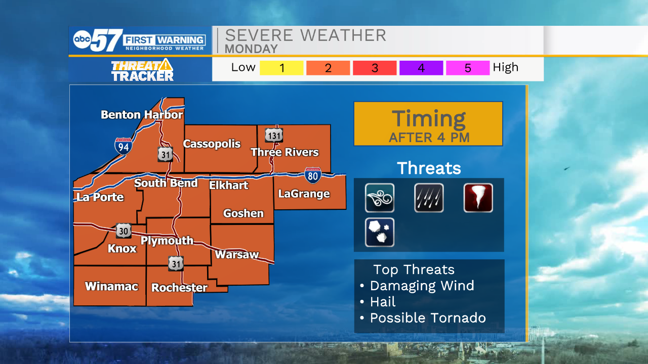
Strong to severe storms arrive Monday afternoon and evening


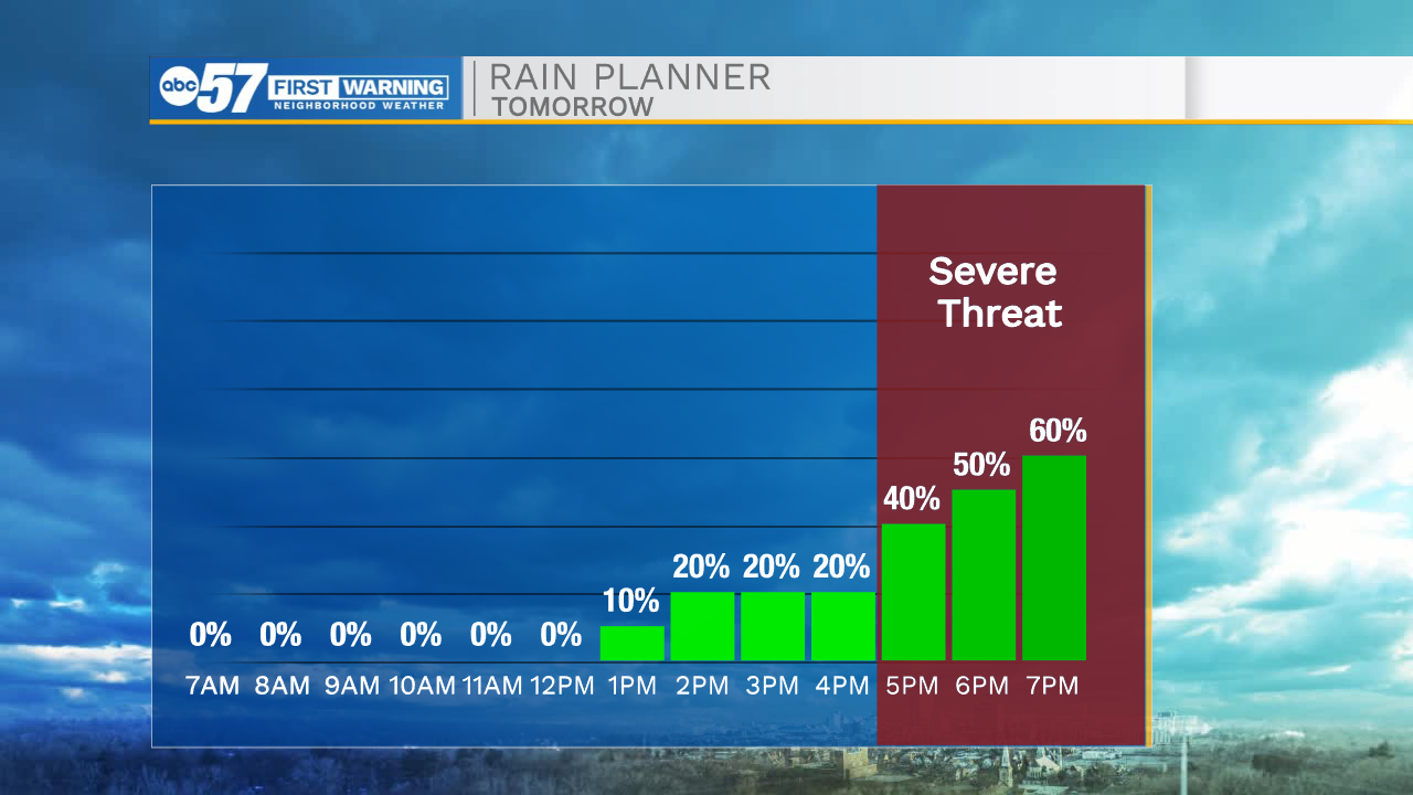
Cloud cover will slowly increase tonight helping to keep temperatures in the upper 60s tomorrow morning. Mostly cloudy skies will remain into the afternoon but temperatures will still climb into the lower 80s for highs. A strong cold front will approach out of the west during the afternoon and evening. Along this cold front, scattered showers and storms are expected. A few of the storms could be on the strong to severe side with all threats of severe weather possible. Make sure to stay weather aware tomorrow afternoon and evening. Showers and storm will clear into Tuesday morning. Low rain chances are in the forecast for Wednesday, but then things turn scattered again into Thursday and Friday. After Friday’s cold front temperatures will drop into the 60s for highs next weekend.
Tonight: Mostly cloudy. Low 68.
Tomorrow: PM Thunderstorms. High 82.
Tuesday: Partly cloudy. High 72.
Wednesday: Partly cloudy. High 76.