Strong to severe storms look to impact Michiana tonight


Storms will begin to move into Michiana anytime after 4pm with better chances around 6pm. Scattered strong to severe storms are likely this evening with all modes of severe weather possible; strong winds, large hail, and an isolated tornado or two. The first round of storms will linger till 8 or 9pm, then we will see a break in storm activity till midnight. The second round of storms will impact Michiana during the early morning tomorrow. The second round of storms do have the chance to be on the strong to severe side as well, still with all severe threats possible. Rain and storm activity will begin to clear out by mid to late morning tomorrow. After the cold front moves through Michiana we will see a big drop in temperatures and humidity through the middle part of the work week.
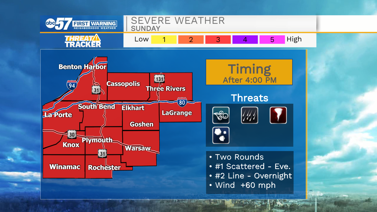
Tonight: Scattered strong to severe storms. Low 64.
Tomorrow: AM showers. High 74.
Tuesday: Partly cloudy to mostly sunny. High 70.
Wednesday: Mostly sunny. High 78.