Strong to severe storms possible Sunday evening
![](/images/abclogo_gray.png?x)
-
2:30
Mishawaka ‘Designated Outdoor Refreshment Area’ along riverwalk...
-
0:50
Saint Mary’s College breaks ground on Heritage and Research...
-
6:13
Rep. Rudy Yakym discusses Netanyahu’s address to Congress and...
-
3:41
Three civil rights lawsuits filed against Elkhart Police
-
1:03
The humidity returns, Sunday
-
1:57
Why the dew point is the best way to represent humidity
-
4:18
What is Project 2025 and why does it matter?
-
0:45
The South Bend Police Department hosts inaugural community track...
-
1:10
’A Rosie Place’ in South Bend welcomes new equine friend
-
1:42
Thanks to the weather, Michiana corn seeing rapid growth
-
4:10
Developing Downtowns: South Bend
-
2:25
After closure in 2020, YMCA reopens in downtown
Chance for strong to severe storms starting this afternoon
![](https://newscdn2.weigelbroadcasting.com/WeK5P-1624205713-embed-Day%201%20SPC%20Severe%20Risk%20%281%29.png)
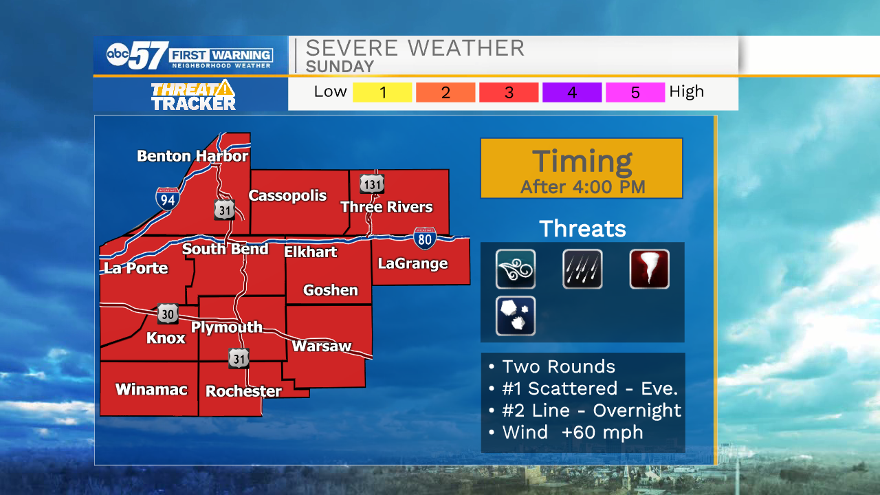
It’s another hot and humid day with the chance for strong to severe storms by late this afternoon. If you’re planning on celebrating dad with some fishing or golfing, make those plans to get outdoors earlier in the day. Sunny skies early will become increasingly cloudy through the afternoon as we warm near 90 degrees.
![](https://newscdn2.weigelbroadcasting.com/xlhJK-1624187296-embed-Today%20Breakdown.png)
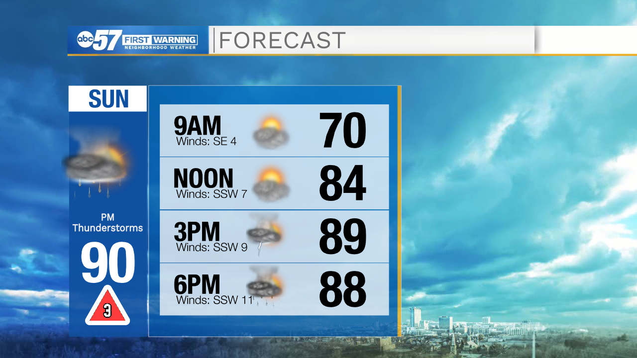
Scattered thunderstorms likely start to pop after 3 p.m. Keep an eye on radar around this time and remember, when thunder roars go indoors.
![](https://newscdn2.weigelbroadcasting.com/DCjbR-1624187222-embed-IBM%204K%20FORECAST%20TRACK.png)
![](https://newscdn2.weigelbroadcasting.com/rWZT3-1624187230-embed-IBM%204K%20FORECAST%20TRACK2.png)
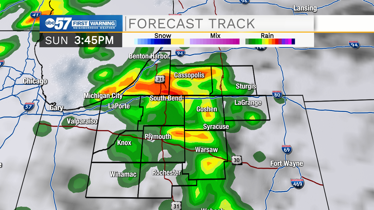
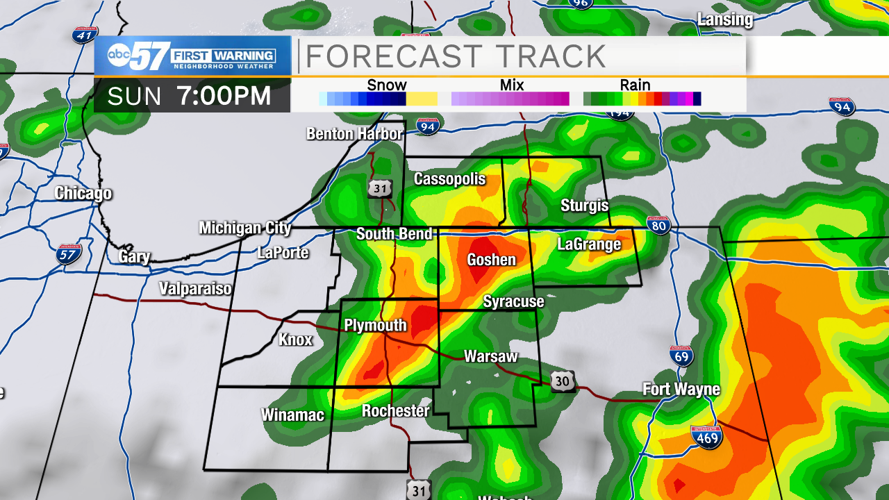
The biggest threats for storms tonight is damaging gusty winds. We also could see hail and periods of heavy rain. The possibility of a tornado can’t be ruled out.
![](https://newscdn2.weigelbroadcasting.com/Fr13Q-1624187246-embed-Threat%20Tracker.png)
After a brief break from storms late tonight, thunderstorms resume early Monday morning (likely after 2 a.m.).
![](https://newscdn2.weigelbroadcasting.com/19FkK-1624205699-embed-Threat%20Tracker%20Timeline.png)
Out the door tomorrow, you’ll likely still need an umbrella with showers expected through early afternoon, but no more thunderstorms.
Temperatures are cooler Monday and Tuesday in the low 70s before a warming trend starts Wednesday.
Today: Mix of sun and clouds. Thunderstorms (possibly strong or severe) in the afternoon and evening. High 90.
Tonight: Thunderstorms (possibly strong or severe). Low 66.
Monday: Scattered showers. Breezy. High 74.
Tuesday: Mostly sunny. High 70.