


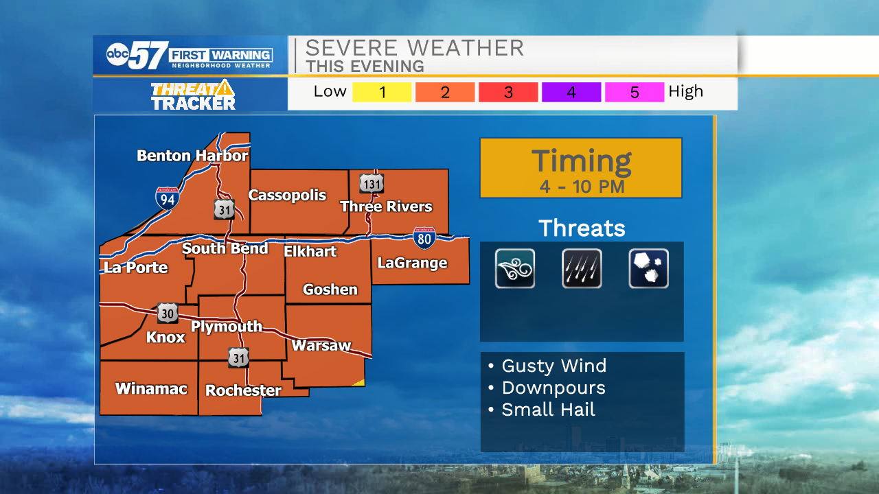
Strong to Severe Storms Possible This Afternoon / Evening
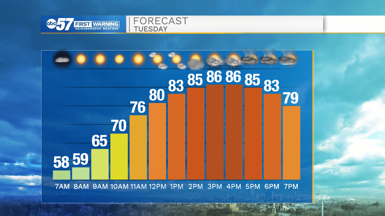
This morning is nice and quiet as we start our shortened work week. Temperatures are in the mid to upper 50s out the door, so you may want to grab a jacket. Temperatures warm quite a bit by afternoon – a high in the mid to upper 80s will make today the warmest of the week.
Cloud cover increases as we head into the afternoon. There will be a line of thunderstorms ahead of a cold front, arriving late this afternoon/early evening. This line will bring potentially damaging wind gusts, periods of heavy rain, and possibly hail. The line moves quickly, so flooding concerns stay low.
Storms exit Michiana by midnight. Things are quieter and cooler to end the week. There is plenty of sunshine to enjoy Wednesday through the weekend. There’s a slight chance for a lake effect shower Wednesday overnight into early Thursday morning, otherwise rain chances hold off until next week.
Today: Becoming windy. Strong/severe storms possible in the evening. High 86.
Tonight: Storms before midnight. Partly cloudy. Low 60.
Wednesday: Sunny. High 75.
Thursday: Sunny. High 74.