


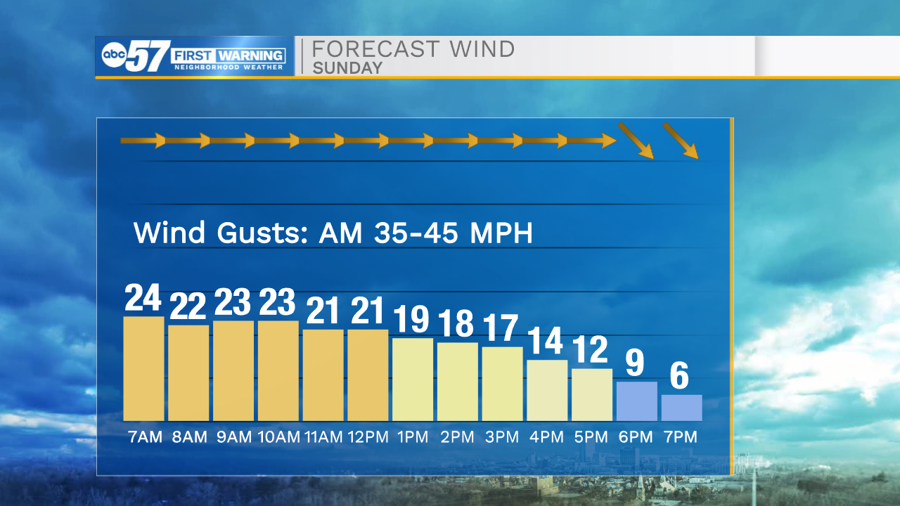
This morning winds are still gusting into the 40-50mph range, and will continue to do so until 11am this morning. Due to the strong winds throughout the first half of the day, make sure to refrain from burning anything as fires can get out of control at a very rapid pace. Temperatures will mostly stay in the 40s today. Tonight another round of rain will move in, then turn to mixed wintry precip and snow by Monday morning. A few isolated lake effect snow showers will persist into Monday evening. Snow accumulations could total close to 1-2 inches in northwestern Michiana. We will clear things out into Tuesday and Wednesday as sunshine and 40 degree temperatures return. Most of this week looks dry and quiet, until we get to Thursday night and Friday. Another front will bring snow chances and colder temperatures heading into next weekend.
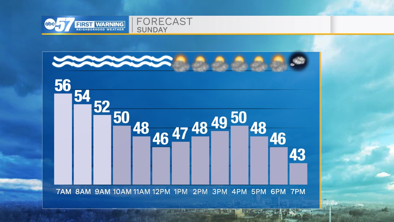
Today: Mostly cloudy/windy. High 50.
Tonight: Rain/snow. Low 36.
Tomorrow: Isolated snow showers. High 38.
Tuesday: Mostly sunny. High 42.