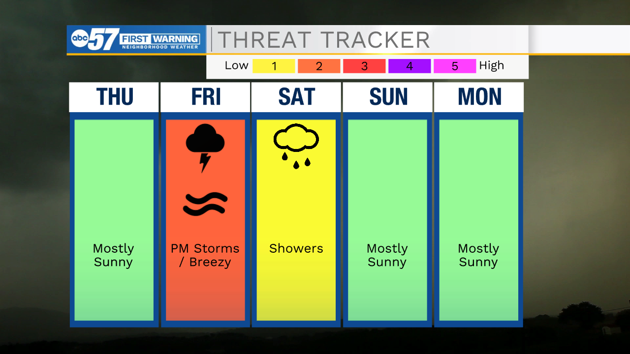
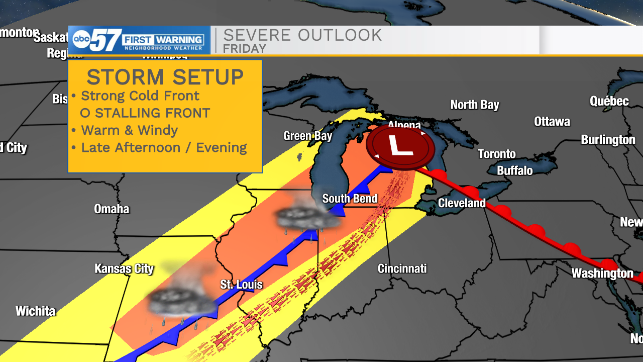
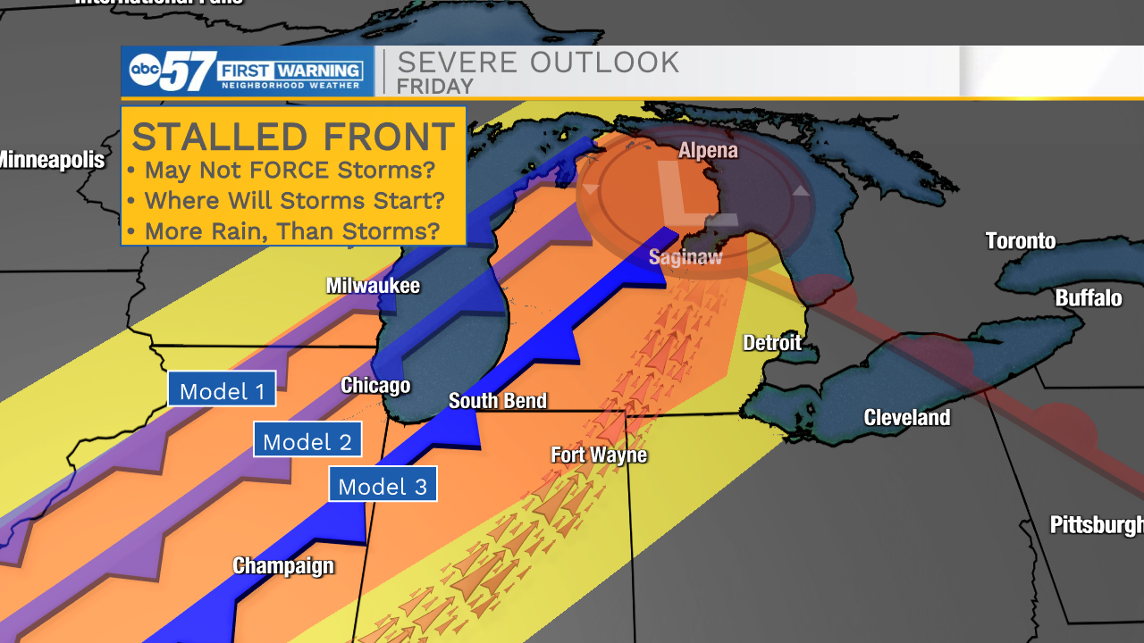
Temperatures spike and highs warm into the 80s Thursday and Friday. Thursday is dry, as is more of Friday until showers and storms develop with an approaching cold front. The possibility of severe weather remains an concern, with a strong cold front (80s on one side, 60s the other). There will be plenty of storm energy ahead of the front, yet doubt remains that severe storms may actually develop. Models reflect low confidence despite favorable storm ingredients. One factor may be a lagging to stalling cold front, that may lack the force to start storms. There is a definite 'bust' factor and widespread severe weather ( it may not happen), but widespread rain through Saturday is looking more likely with the slower front.
Tonight: Showers early. Low 52.
Thursday: Mostly sunny. High 82.
Friday: Breezy, PM T-Storms. High 88.
Saturday: T-Showers. High 66.
Sunday: Partly cloudy. High 62.