
-
1:28

Stormy start to the week
-
0:59

Hot and cloudy today
-
1:03

Calm, warmer out the door
-
0:34

SBPD investigating shooting after walk-in gunshot victim
-
0:37

Tolson Center kicks off soccer season
-
1:37

No. 2 Notre Dame lacrosse defeats No. 1 North Carolina in 10-5...
-
0:53

South Bend celebrates Skilled Trades Day with Rebuilding Together...
-
2:32

Church hosts ‘Possibility Day’ to promote disability inclusion...
-
0:50

Springlike today, hotter tomorrow
-
0:44

A possibly frosty morning
-
1:16

Hundreds gathered at a local Michiana brewery in hopes of breaking...
-
2:45

Ag Days 2026 kicks off Friday at the St. Joseph County Fairgrounds

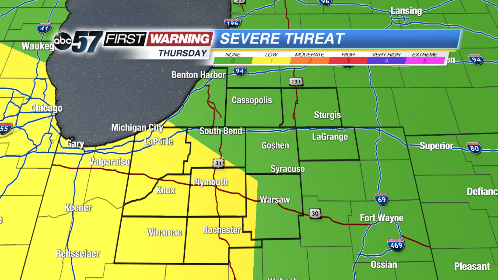
A very typical August pattern ahead. Warm sunny days produce afternoon clouds, some clouds develop into isolated thunderstorms. The pattern continues through the weekend. One thing to watch Thursday afternoon will be a line of storms that could develop to our west and bring a severe threat west of US-31.
Tonight: Partly to mostly clear, low of 64.
Thursday: Partly cloudy, isolated PM storms, high of 86.
Friday: Partly cloudy, isolated PM storms, high of 84.
Saturday: Partly cloudy, isolated PM storms, high of 82.
Sign up for the ABC 57 Newsletter