


Expect another snowy day to end the weekend. Snow moves from west to east this morning across Michiana. Snow becomes more widespread by afternoon.
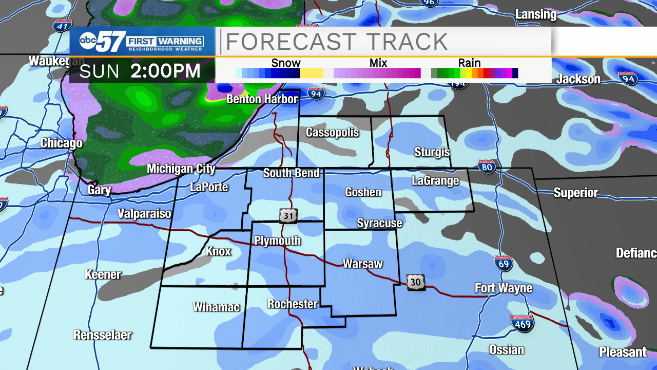
There could be a few bursts of intense snow, leading to low visibility if driving. Pavement is still wet, but snow could begin to accumulate there, especially during the intense bursts. Take it slow if you're heading out on the roads.
Snow will have an easier time sticking in the grassy areas. By this evening, 1-2" is possible for most of Michiana.
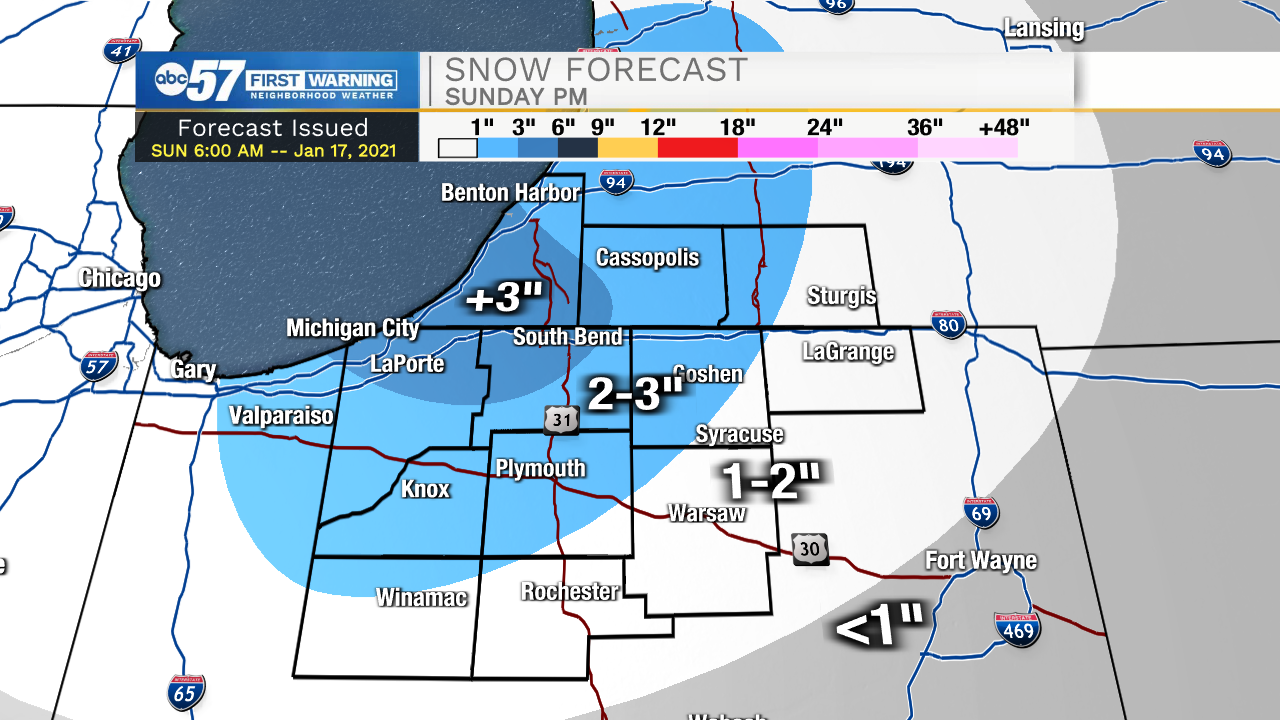
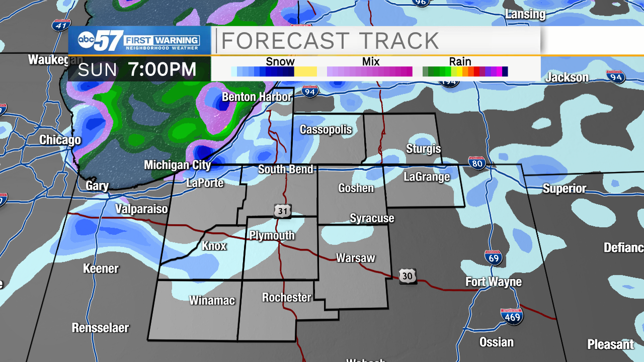
Overnight, lake effect snow kicks in. Areas near the lakeshore (parts of Berrien, LaPorte, Cass, and St. Joe County, IN) could pick up an additional 1-2" of lake effect snow overnight. These areas could see 3", possibly even 4" in a few spots, by Monday morning.
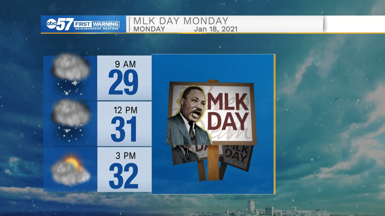
Snow showers become scattered to isolated Monday, and most taper off by noon. The rest of the week looks to stay quiet.
Today: Snow. Temperatures steady in the low 30s.
Tonight: Snow showers. Low 28.
Monday: Snow showers taper off. Mostly cloudy. High 32.
Tuesday: Mostly to partly cloudy. High 30.