


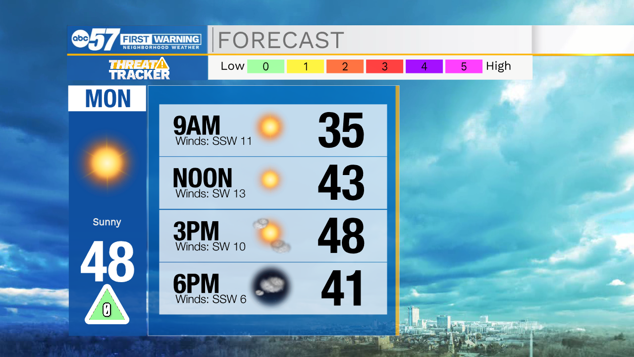
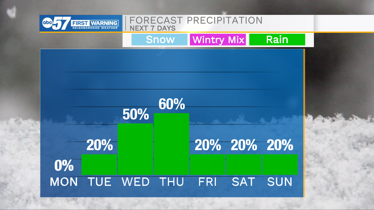
Cool but clear conditions will stick with us through the overnight hours. Temperatures tomorrow morning will drop into the lower 30s. High temperatures tomorrow afternoon will top out in the upper 40s under sunny skies. Overall it looks to be a great start to the work week. Cloud cover will increase into Tuesday, but still some sunshine will stick around. Highs Tuesday will be in the lower 50s. A few stray showers are possible late Tuesday evening, and will increase in coverage Wednesday morning. Off and on isolated showers will linger throughout Wednesday. A cold front will swing through Michiana Thursday morning bringing more scattered showers and a few thunderstorms. After the front clears, high temperatures will begin to drop back into the 30s for next weekend.
Tonight: Mostly clear. Low 32.
Tomorrow: Sunny. High 48.
Tuesday: Partly cloudy. High 52.
Wednesday: Isolated showers. High 62.