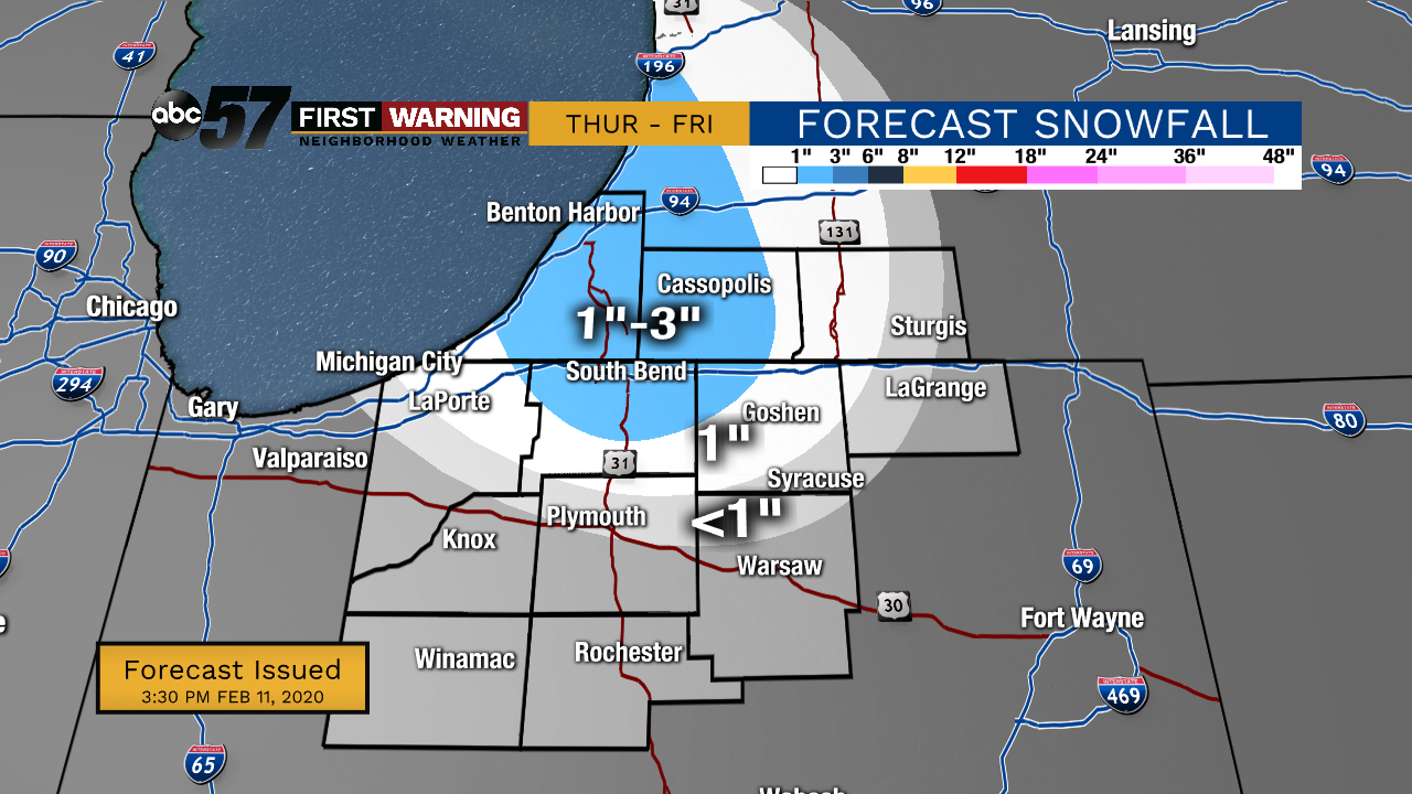
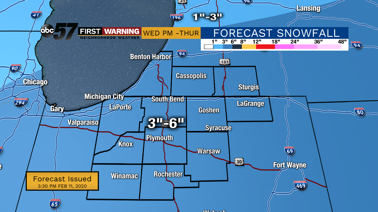
Wednesday morning is quiet with increasing cloud cover ahead of the afternoon snow. Snow showers start in the afternoon, and by 5 PM heavier snow starts. The high temperature Wednesday is 36, which means a wet snow. 3-4 inches is expected by Thursday morning. Additionally, there will be lake effect snow Thursday evening and lingering into Friday morning, which will add to the snowfall total. Temperatures drop significantly Thursday afternoon. We will see single digit temperatures Thursday and Friday nights. High temperatures in the 30s will return by the weekend.
Tonight: Partly cloudy. Low 24.
Wednesday: Increasing cloud cover. Afternoon mix/snow showers, then evening snow. High 36.
Thursday: Lake effect snow showers. Temperatures drop throughout the day from 30 degrees. Low 9.
Friday: A few lingering flurries early. High 18.