Temperatures on the rise with a chance of storms midweek

-
0:34

South Bend Community Review Board hosts open discussion on youth...
-
2:19

INDOT walks through a proposed diverging diamond intersection...
-
1:08

Notre Dame’s Leonard Moore highlights student success and raises...
-
1:05

Mayflower Bridge set to close beginning April 6
-
0:21

Colfax Avenue eastbound lane closed for water and sewer work
-
0:46

Madison Street closed for lifestyle district project
-
4:11

Non-profit organization provides deep dive into Blackstone, a...
-
1:52

Storms possible overnight, strong storms by Tuesday evening
-
3:48

New partnership aims to help fight food insecurity across Elkhart...
-
2:00

A sunny Monday ahead, rainy almost every other day this week
-
2:59

Dusty May leads Michigan back to Final Four with dominant win...
-
0:37

Vendors and cosplayers showcase art at South Bend Anime Fest

Monday, June 1st, 2020
Clouds increase past midday with isolated showers possible this evening. You'll need your A/C back on tomorrow as temperatures climb into the mid 80s with humidity on the rise as well. Wednesday brings in the chance of a couple of showers and thunderstorms but the day does not look to be a washout. We are back to sunshine Thursday before the next chance of storms arrives Friday afternoon. That'll bring some relief from the heat heading into the weekend.
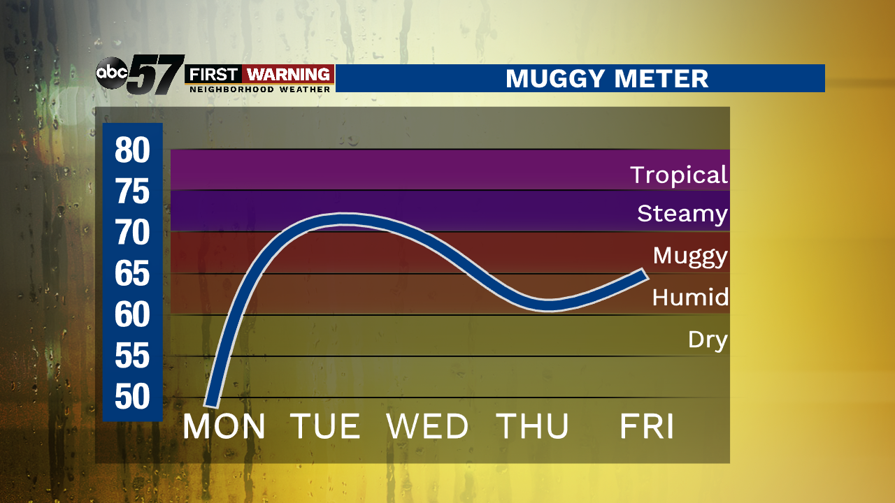
Today: Mostly sunny early. Increasing cloud cover with a chance of evening showers. High of 74.
Tonight: Mostly cloudy, showers possible. Low of 60.
Tuesday: Partly cloudy, breezy. Humidity returns. High of 86.
Wednesday: Couple of showers and thunderstorms, especially in the afternoon. High of 82.