
-
1:08

Notre Dame’s Leonard Moore highlights student success and raises...
-
1:05

Mayflower Bridge set to close beginning April 6
-
0:21

Colfax Avenue eastbound lane closed for water and sewer work
-
0:46

Madison Street closed for lifestyle district project
-
4:11

Non-profit organization provides deep dive into Blackstone, a...
-
1:52

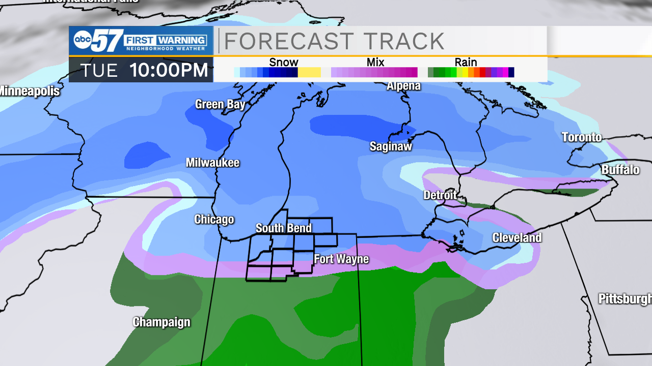
Storms possible overnight, strong storms by Tuesday evening
-
3:48

New partnership aims to help fight food insecurity across Elkhart...
-
2:00

A sunny Monday ahead, rainy almost every other day this week
-
2:59

Dusty May leads Michigan back to Final Four with dominant win...
-
0:37

Vendors and cosplayers showcase art at South Bend Anime Fest
-
3:06

Palm Sunday procession in South Bend unites faiths in call to...
-
0:48

2026 Auto Show brings crowd to Century Center Sunday

The clouds break Thursday and temperatures warm into the mid-50s, a south breeze could be a tad blustery, but still a nice day. Friday a few rain showers are possible and temperatures fall into Saturday. Sunday is looking wetter and wetter, then temperatures fall into Monday, when snow showers are possible. If you're concerned about snow accumulation, the focus is now Tuesday, however temperatures are still questionable if this will be slush or snow. But Tuesday night is now the best chance of accumulating snow.
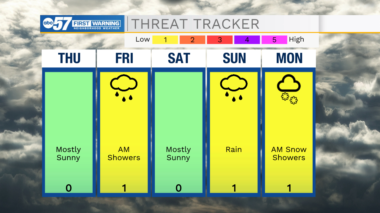
Tonight: Mostly cloudy and breezy. Low 42.
Thursday: Mostly sunny. Breezy. High 55.
Friday: Mostly cloudy, chance of rain. High 48.
Saturday: Mostly sunny. High 40.
Sign up for the ABC 57 Newsletter