How do we get different types of winter weather?
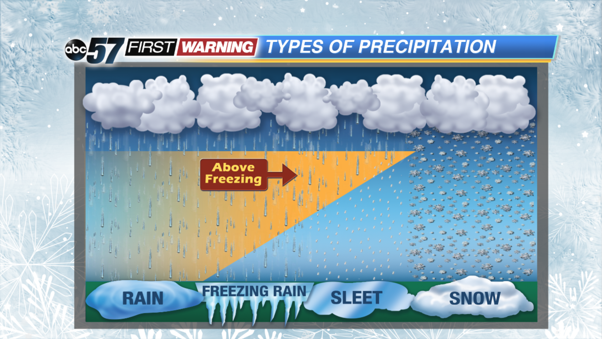
Now that we're really starting to cool down here in Michiana, the possibility is there to see some wintry precipitation falling during the early morning hours for the next couple of days. Lake effect snow showers are possible late Thursday night as morning lows are expected to fall into the lower 20s, but we could easily see some sleet or wintry mix before transitioning to all snow. So you might ask yourself, how come we get different types of winter weather? Well, it all depends on the air temperature between the clouds and the ground.
All forms of precip fall out of the base of the cloud as snow, even in the summer time. When temperatures are below freezing all the way to the ground, that snow is able to make it all the way to the surface.
When a shallow layer of warm air moves in, that snow will melt into rain and then refreeze as it falls back into that larger section of cold air before hitting the ground. This is called sleet. It's easy to tell when sleet is falling because it looks like tiny hail stones as they bounce when landing.
A deeper layer of warm air between the cloud and the ground, allows that snow to melt into rain and stay as rain all the way to the surface. When the raindrop hits the ground, it freezes on contact due to the cold layer of air at the surface.
Finally, when temperatures are above 32 degrees entirely from the cloud base to the surface, we get rain!


