The heat and humidity build in with storm chances late Friday


ABC57 First Warning Neighborhood Weather
Thursday, June 25th, 2020
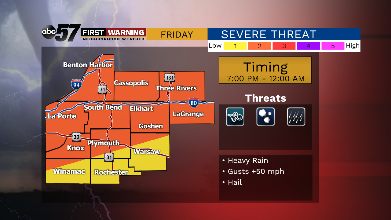
We warm back to 80F today with sunnier skies. An isolated shower is possible Friday morning, otherwise partly cloudy skies. Friday evening, isolated storms are possible but look more likely Friday night into Saturday morning. There is a chance of strong to severe storms with strong wind gusts being the main threat.
After morning storms Saturday morning, an isolated storm will be possible later in the day but it does looks like clouds will break up. Most of Sunday is dry with just an isolated storm possible. Both the heat and humidity build in starting Friday. The hot weather lasts through next week into the holiday weekend.
Today: Mostly sunny. High 80.
Tonight: Mostly clear. Low 60.
Friday: Partly cloudy with isolated storms possible in the evening. High 88.
Saturday: Thunderstorms likely, especially in the morning. High 85.