The wet and steamy pattern continues through Wednesday
By: Emily Kennedy
Posted: Jun 29, 2021 2:35 AM EDT

-
2:56

The partial government shutdown is impacting travel across the...
-
1:33

Cool out the door, Mild by afternoon
-
1:50

Top Ten Snow Year 2025-26
-
1:17

South Bend Cubs unveil fan-focused upgrades ahead of Opening...
-
2:21

Notre Dame Fighting Irish ready for spring football
-
2:06

Fighting Irish using time off to refocus ahead of spring practice
-
2:35

What are the privacy implications of SBPD’s ’Drone as First...
-
1:22

Expert discusses Wednesday’s Fed decision
-
3:19

New legislation could make Michigan the 30th constitutional carry...
-
2:15

SBPD using drones to help improve response time
-
1:20

The March roller coaster ride continues
-
1:52

Snow today, rain tomorrow, and warm this weekend

ABC57 First Warning Neighborhood Weather Forecast
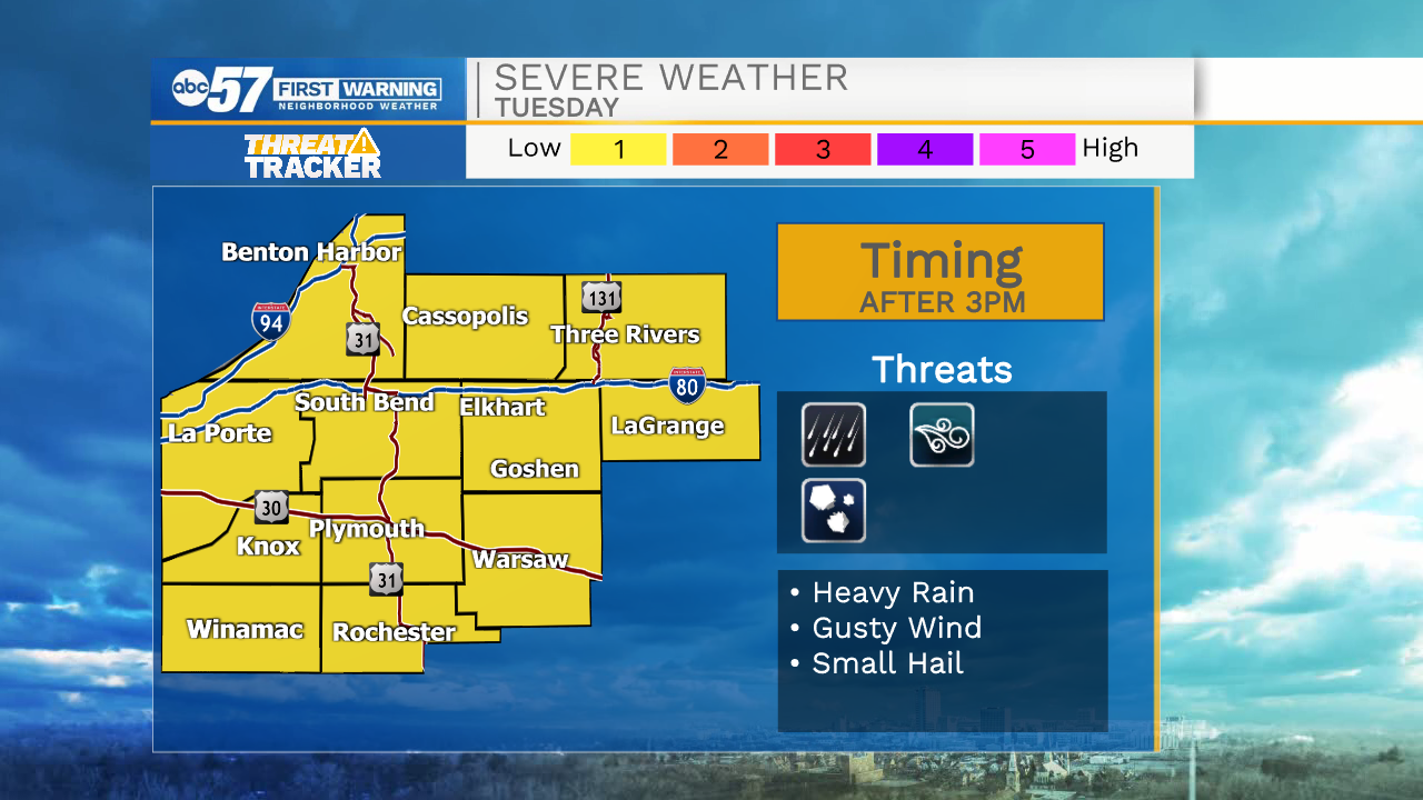
Tuesday, June 29th, 2021
A stray shower or storm this morning with more scattered thunderstorms developing this afternoon. Storms could be stronger with gusty wind and heavy rain. The steamy weather continues through Wednesday with more scattered thunderstorms. A cold front moves through Wednesday night into Thursday morning, bringing one last round of rain before we get a dry weekend! 4th of July weekend is looking really nice.
Today: Scattered showers and storms. High 86.
Tonight: Isolated thunderstorms. Low 70.
Wednesday: Scattered thunderstorms. High 80.
Thursday: Partly cloudy, stray shower/storm. High 80.
Sign up for the ABC 57 Newsletter