Thunderstorms and strong winds move into Michiana tonight


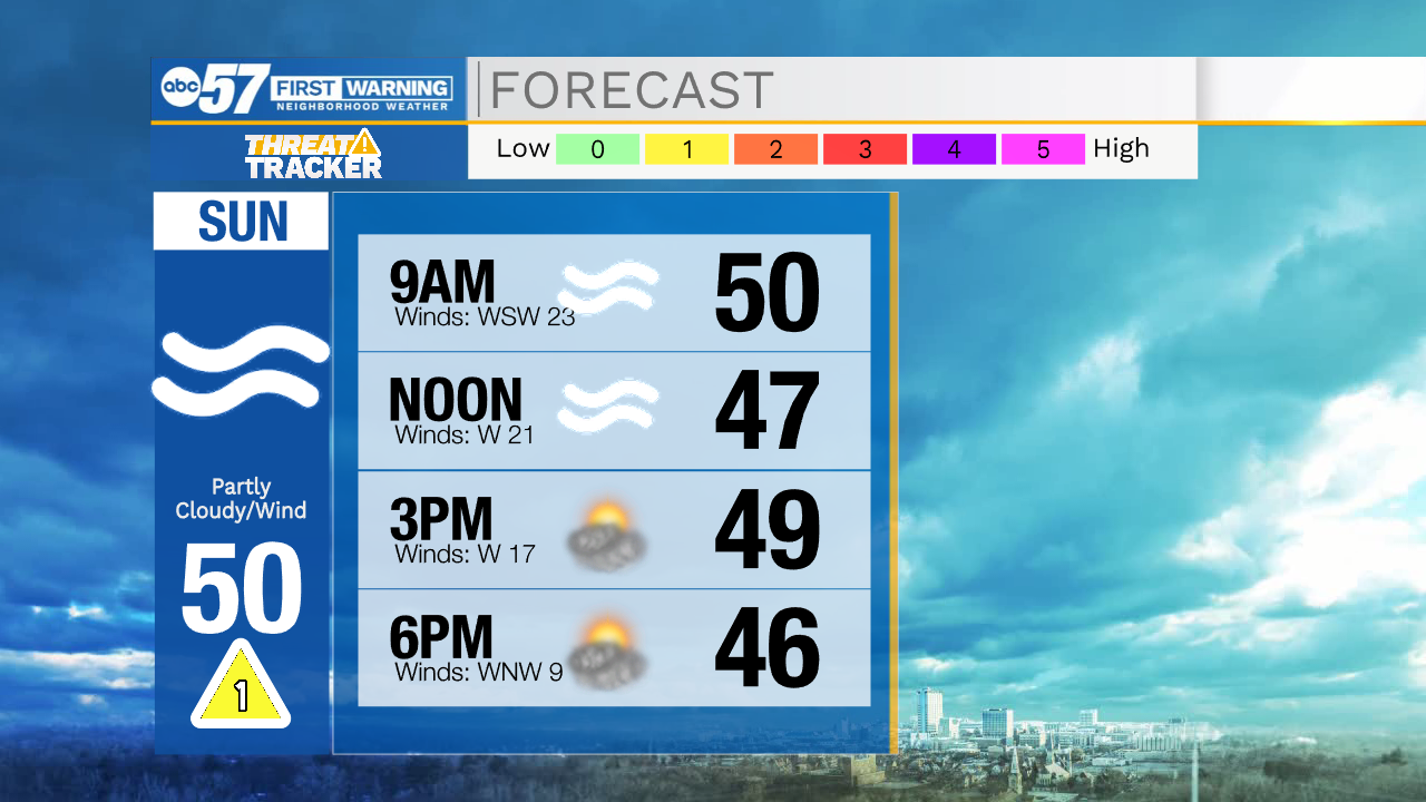
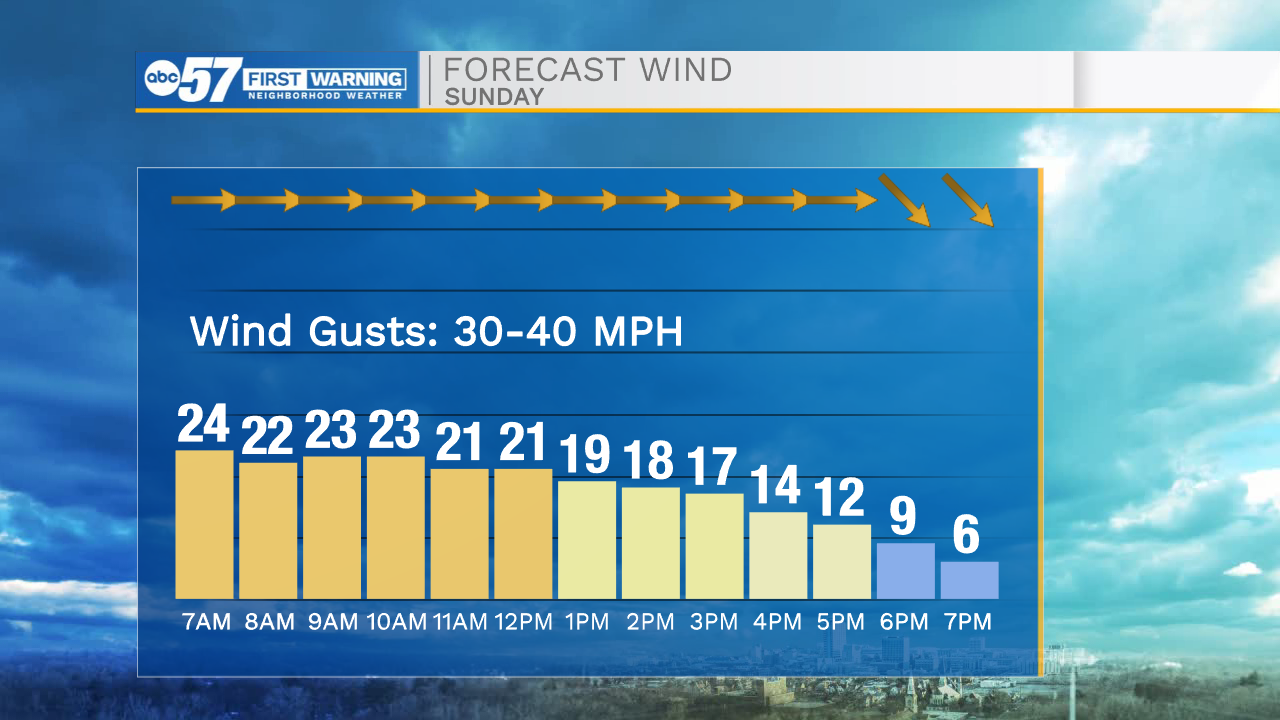
Hopefully you have been outside today to enjoy the nice weather, because big changes will be moving in tonight and tomorrow. Winds will continue to increase this evening, as a wind advisory is in effect from 10pm tonight until 11am tomorrow morning. Gusts could reach 40-50mph. Along with the strong winds there is the chance for a few strong to low end severe storms. These storms look to primarily impact Michiana from 10pm tonight until 2am tomorrow morning. Winds will finally start to weaken tomorrow afternoon. Temperatures will stay mostly in the 50s for your Sunday. Another round of rain arrives tomorrow evening and will turn to snow Monday morning. Snow showers will impact northwestern Michiana through Monday afternoon. Overall accumulations look to stay on the lower side, due to the warmer temperatures we are experiencing this weekend.
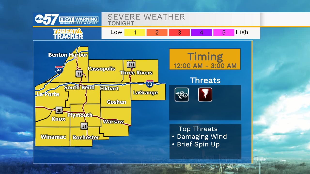
Tonight: Windy/thunderstorms. Low 55.
Tomorrow: Windy. High 50.
Monday: Rain/snow showers. High 38.
Tuesday: Mostly sunny. High 42.