Tracking another round of storms Wednesday night
By: Emily Kennedy
Posted: Oct 12, 2021 3:30 AM EDT

-
0:47

Nappanee became Candyland Saturday
-
2:01

The Juneteenth Cultural Alliance hosts Juneteenth celebrations...
-
1:11

Morning rain, breezy afternoon
-
0:53

Showers out the door
-
0:38

Two injured in overnight shooting
-
2:52

Cleanup efforts continue in Kouts after EF-3 Tornado
-
2:04

Michiana PrideFest celebrates its 5th year with a sports theme
-
0:54

Much cooler next week, Highs in the 70s
-
0:53

’Hop On and Hire’ event held Saturday for prospective bus...
-
1:32

Storms return overnight
-
1:30

Pleasant today, storms tonight
-
0:51

Summer-like through today
ABC57 First Warning Neighborhood Weather Forecast
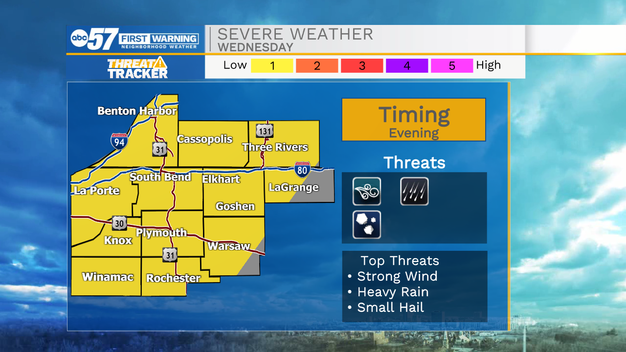
Tuesday, October 12th, 2021
A few more clouds will hang around for part of Tuesday with areas of drizzle possible, especially in the morning. More sunshine and warmer on Wednesday. Another round of showers and storms moves through Wednesday night into Thursday morning. As these storms first move in, they could be strong. The chance of rain continues for Friday and true fall weather arrives behind it over the weekend.
Today: Mostly cloudy. High 70.
Tonight: Partly cloudy. Low 54.
Wednesday: Partly cloudy. High 76.
Thursday: Rain showers. High 72.
Sign up for the ABC 57 Newsletter