Tracking bitter cold temperatures and strong winds during the work week


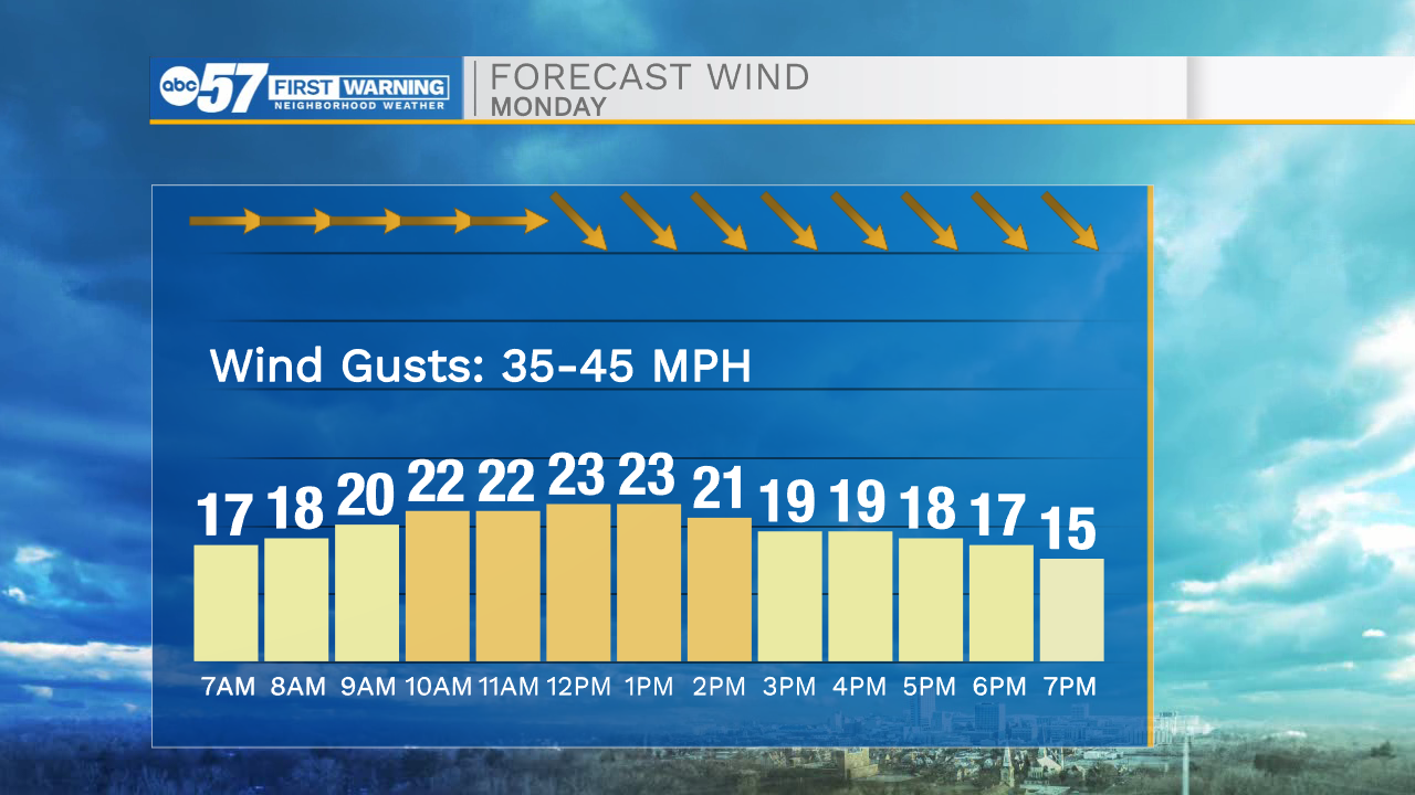
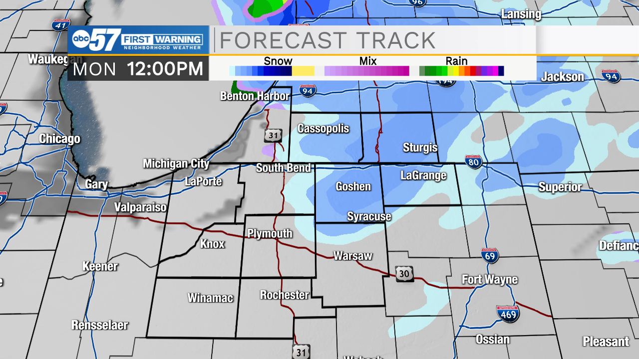
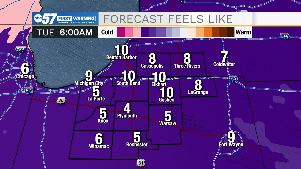
Rain showers will remain in the forecast for the rest of the evening. Around midnight all rain will clear out, but a few isolated flurries will linger through Monday morning and afternoon. The big thing for Monday will be the strong winds and bitter cold wind chills. Winds look to gust into the 35-45mph range. Power outages are possible, so make sure to keep your phone charged throughout the day. With strong winds and cold temperatures, wind chills into Monday evening will already be in the teens, and then Tuesday morning the single digits. Bundle up in multiple layers. Winds will begin to subside Tuesday afternoon. Tuesday and Wednesday a few more isolated flurries and light snow showers are possible, but little to no impacts are expected on the roadways. Temperatures will rebound into the 40s for Thursday and Friday.
Tonight: Cloudy/flurries. Low 30.
Tomorrow: Very windy! High 35.
Tuesday: Partly cloudy. High 28.
Wednesday: Isolated flurries. High 35.