Tracking heavy rain and chance of flooding
By: Emily Kennedy
Posted: Jun 25, 2021 5:25 AM EDT

-
2:00

A sunny Monday ahead, rainy almost every other day this week
-
2:59

Dusty May leads Michigan back to Final Four with dominant win...
-
0:37

Vendors and cosplayers showcase art at South Bend Anime Fest
-
3:06

Palm Sunday procession in South Bend unites faiths in call to...
-
0:48

2026 Auto Show brings crowd to Century Center Sunday
-
2:34

Warm to start the week, Rainy week ahead
-
2:44

Warmer, breezier, and cloudier than yesterday
-
0:46

Crowds gather for Fins and Feathers Fest at La Porte City Fairgrounds
-
0:46

Paramount School of Excellence hosts teacher fair
-
2:30

Voting advocacy, peaceful demonstrations and donations: South...
-
2:04

Warming to start the week, Showers and storms by Tuesday
-
2:10

Cool, but calm, today
ABC57 First Warning Neighborhood Weather Forecast
Friday, June 25th, 2021
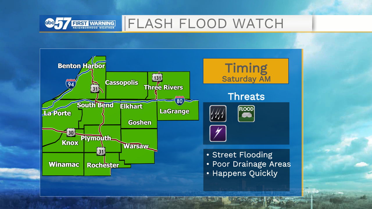
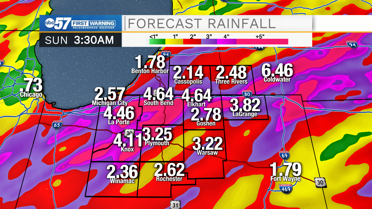
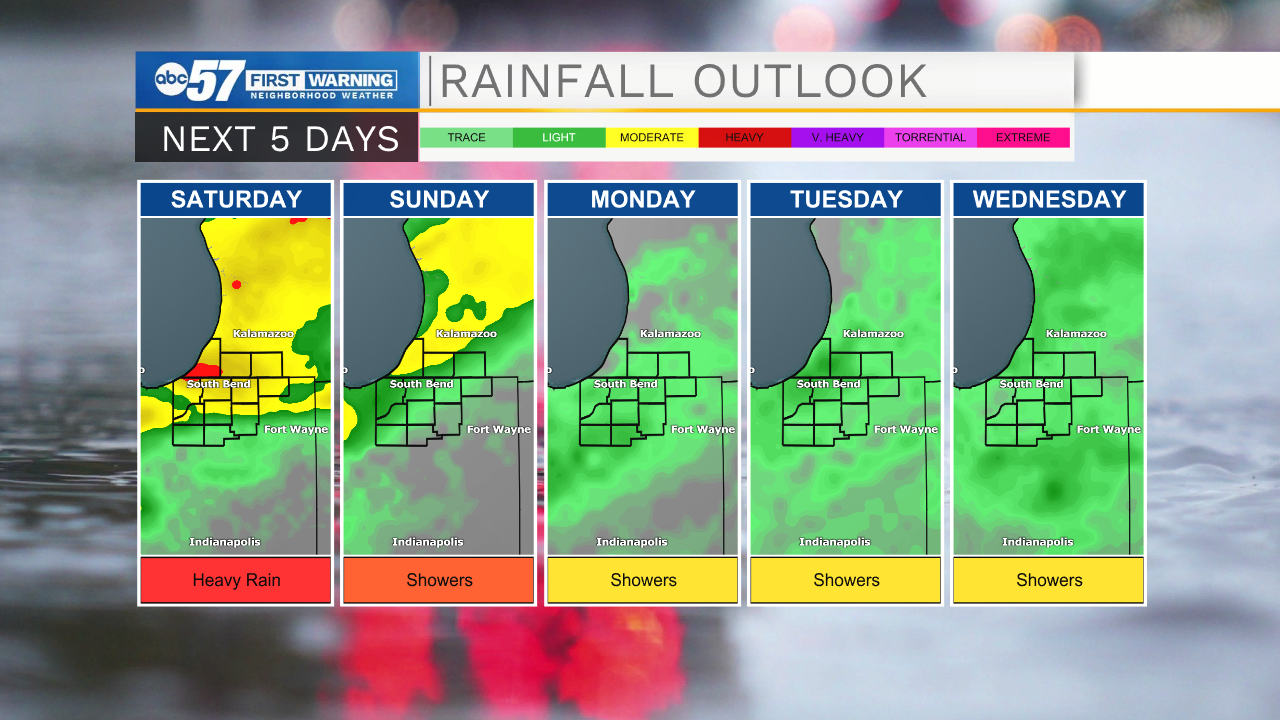
Showers and storms become widespread this morning. Heavy rain is likely at times so be mindful of standing water on the roads during your commute. Scattered storms continue this evening. Storms today could be strong with gusty wind. More scattered showers and storms on Saturday with a couple of breaks in the rain possible. Again heavy rain is a threat which could lead to minor flooding. 2-4" of rain is possible by Sunday evening. We are stuck in the rainy pattern through early next week.
Today: Thundershowers. High 78.
Tonight: Scattered showers and storms. Low 68.
Saturday: Scattered showers and storms. High 82.
Sunday: Scattered showers. High 80.
Sign up for the ABC 57 Newsletter