Tracking more sunshine and cold temperatures for Monday


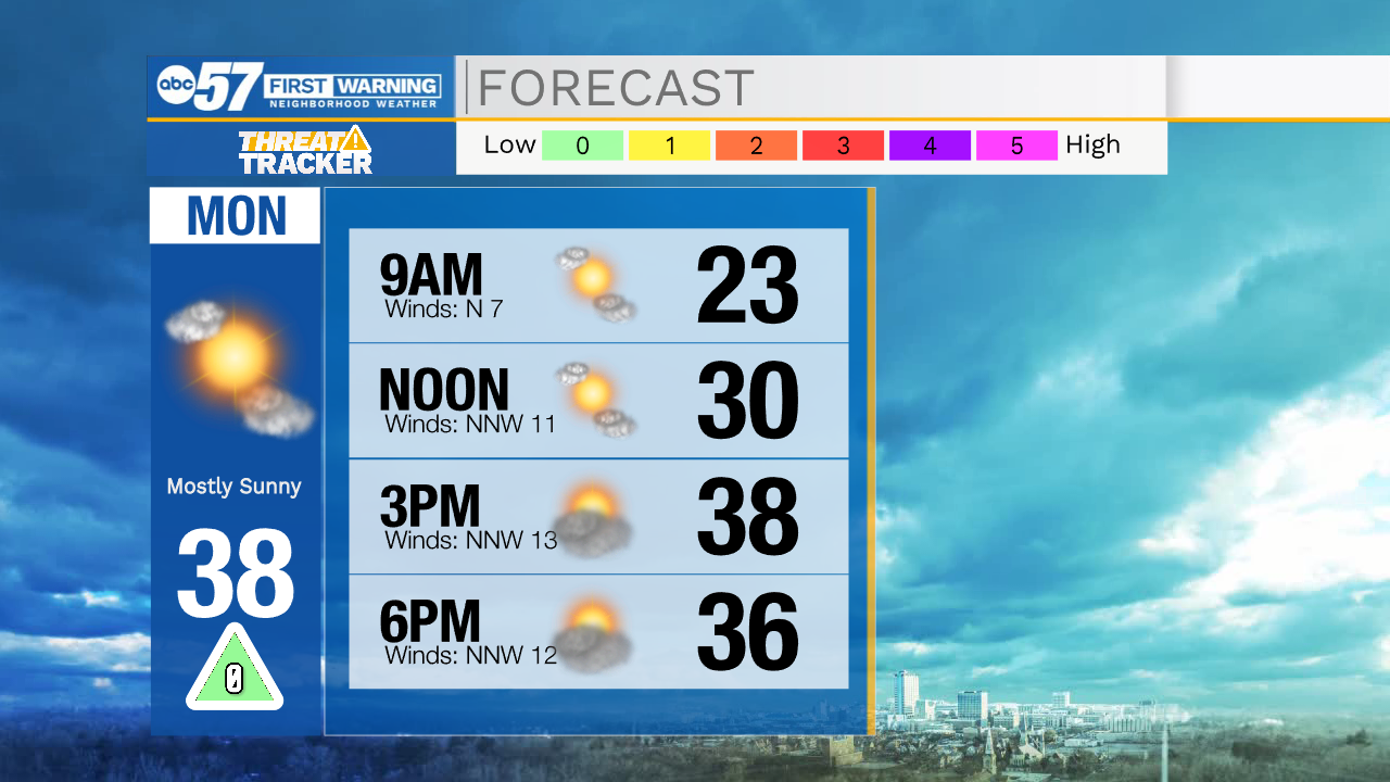
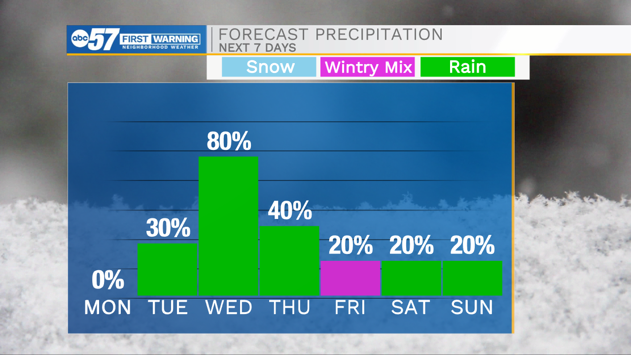
This evening our weather looks to remain quiet, but cold. Temperatures will hold in the 20s with wind chills in the teens. If you are heading out for any Sunday evening plans, you will want the heavy coat along with you. Tomorrow morning lows will drop near the teens with feel like temperatures close to the single digits. More sunshine returns to the forecast tomorrow, which will help highs reach into the upper 30s. Temperatures will make a big jump into Wednesday, with most places hitting highs in the mid 60s. Our warmer air comes with good rain chances as well. Our next system will move in Tuesday evening, once it arrives, it looks to stall heading into Wednesday bringing more off and on showers. It will finally become more progressive Wednesday evening and move eastward. On the back side of this next system cold air will move in quick allowing for slight mixed wintry precip chances Thursday night into Friday morning. Little to no impacts are expected. High temperatures will hold in the 40s heading into next weekend.
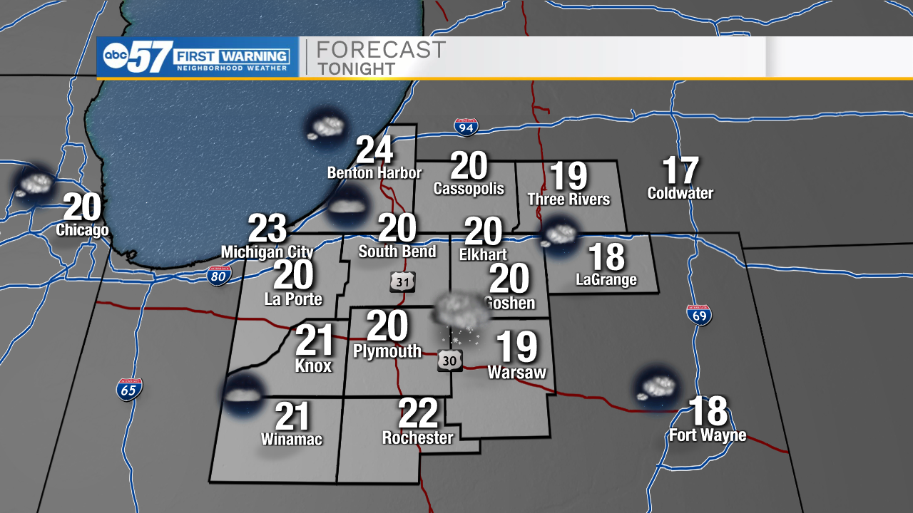
Tonight: Partly cloudy. Low 20.
Tomorrow: Mostly sunny. High 38.
Tuesday: Mostly cloudy/PM rain. High 44.
Wednesday: Scattered showers. High 64.