
-
0:58

Goshen City Council amends DORA rules amid community concerns
-
1:20

SB Common Council adopts Downtown 2045 Plan
-
2:39

Friends and family celebrate life of Jamecia Moffitt
-
1:15

St. Joseph County Council updates residents on Affordability...
-
0:51

Locals gather to recognize farmworkers across Northern Indiana
-
2:07

Impact of higher gas prices for delivery drivers
-
3:43

ND Eviction Clinic exposes ’shameful’ living conditions at...
-
3:59

Neighbors share traffic, noise concerns about proposed Capital...
-
1:50

Leaf pick up resumes in South Bend after weather postpones service...
-
1:02

Another rollercoaster ride to end the week
-
3:41

Present Pillars to host “Dad Strong 5K“ to support fathers...
-
1:44

Warming up through Wednesday

Snow flurries continue tonight into Tuesday. There will not be much of an accumulation, so travel should not be heavily impacted. Some patchy black ice and trace amounts of snow are the primary concerns.
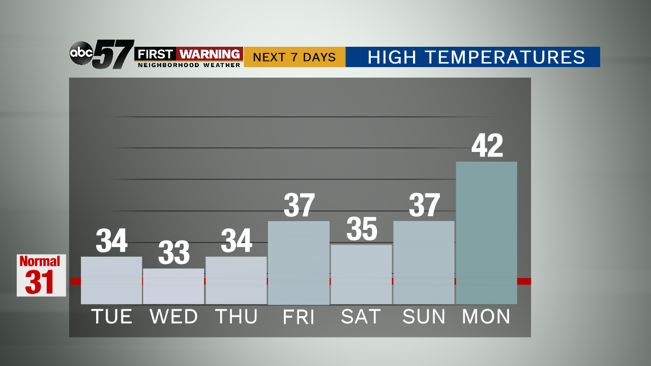
For the remainder of the week, temperatures will be in the mid to upper 30s. Overnight lows are in the upper 20s. This week should stay dry and mostly cloudy. The next chance for snow showers is Friday night and lasts through Saturday. Again, these weekend snow showers are not expected to have a serious impact on travel.
Temperatures remain above normal this week into next. By next Monday, we climb to a high temperature of 42 degrees.
Tonight: A chance of a few flurries and snow showers. Low 30.
Tuesday: A chance of late flurries and snow showers. High 34.
Wednesday: Cloudy. High 33.
Thursday: Mostly cloudy. High 34.