
-
3:47

Elkhart Police Department accepting applications to Citizens...
-
0:52

A slight warm-up but chilly weather still dominates
-
1:09

Bitterly cold out the door
-
3:03

Looking to younger generations to keep Dyngus Day thriving
-
3:06

Even as rivers recede, Marshall County still dealing with flooding
-
3:29

Michigan fans gather in Indianapolis ahead of National Championship...
-
3:22

Hamlet local and tow truck driver describes US 30 crash site...
-
4:28

Dyngus Day celebrations highlight voter turnout, transparency
-
4:54

Now-disbanded St. Joseph County Metro Homicide Unit investigator...
-
0:52

Shots fired on Sunnymede Avenue Saturday, cars and homes struck
-
1:18

Clouds returning and drizzle possible in the afternoon
-
0:57

The cold front passed us, the rain is done for now, and the chill...

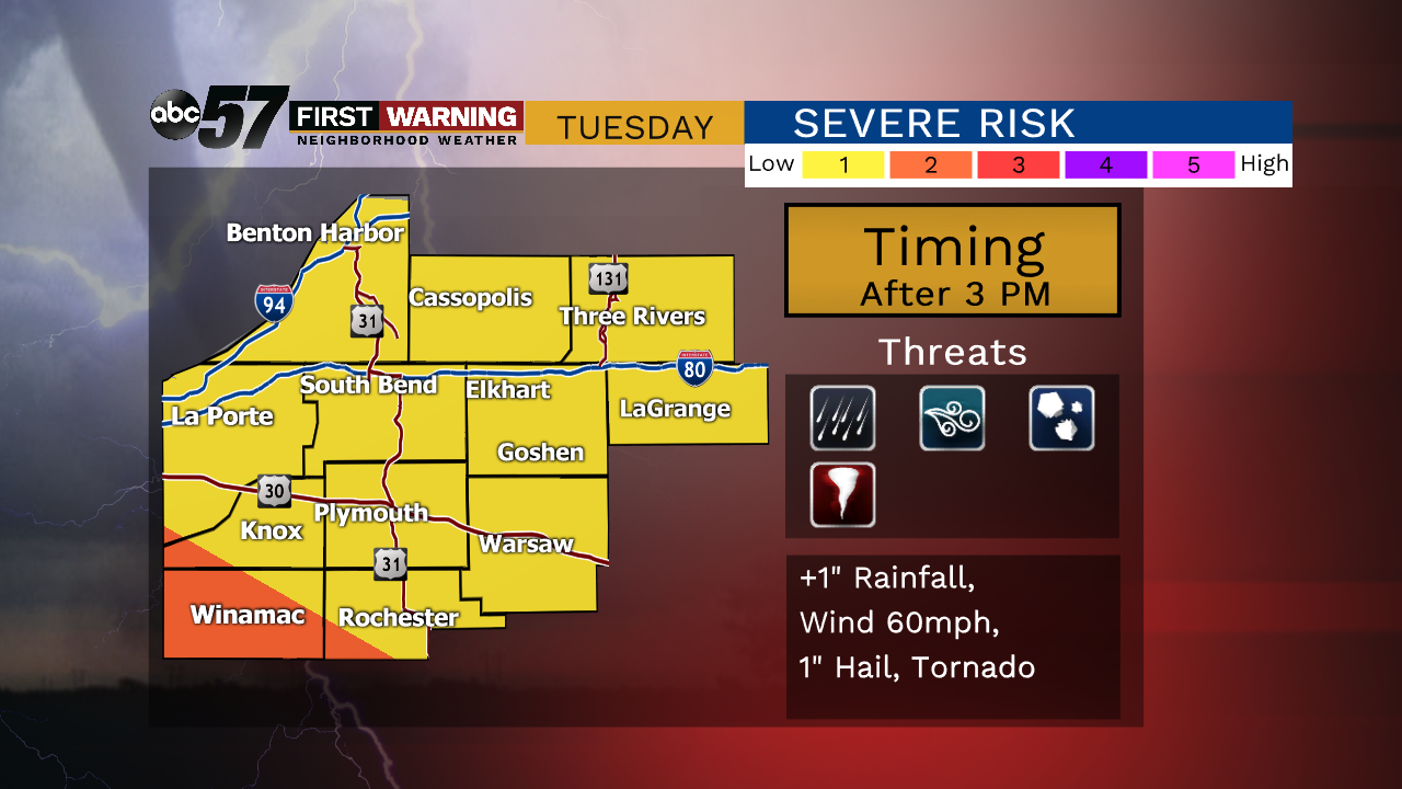
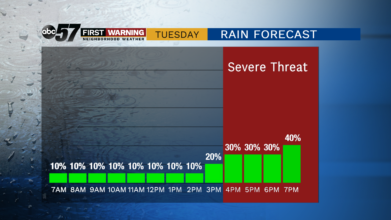
One more day of mugginess with the chance of showers and thunderstorms. An overnight complex of storms could clip the area early Tuesday, otherwise focus will be on afternoon / evening thunderstorm development. Scattered storms bring a low threat of severe weather that includes heavy rain and gusty wind. The pattern changes to end the week, as skies clear the milder temps return.
Tonight: Mostly clear, lows in the mid-60s.
Tuesday: A chance of showers in the morning, then scattered storms in the afternoon, high of 86.
Wednesday: Chance of showers early, partly cloudy, high of 80.
Thursday: Mostly sunny, high of 75.
Sign up for the ABC 57 Newsletter