Turning hotter and more humid, storm chances Wednesday evening

-
2:23

Elkhart County 4H Fair food vendors celebrate 50th year of business
-
2:16

Young football athletes learn about protecting their bodies,...
-
1:24

Storm track timing could be shifting
-
0:57

The Unity Gardens brought music, food, and crafts for their Westside...
-
1:50

Quiet evening, Storms after Midnight
-
0:57

Deer Creek Hunt Club throws a skeet shoot event for Deputy Jon...
-
1:44

Two rounds of storms Monday
-
1:07

Mini heat wave starts out the door
-
2:23

La Porte community rallies for Sammy Strong Benefit, raising...
-
1:57

The Potawatomi Zoo opens its gates to Zoo Nights Live
-
2:50

Carson Kvapil wins his first O’Reilly Auto Parts Series win...
-
1:10

William Tuffs honored as the only Indiana man who took part of...

ABC57 First Warning Neighborhood Weather
Tuesday, July 14th, 2020
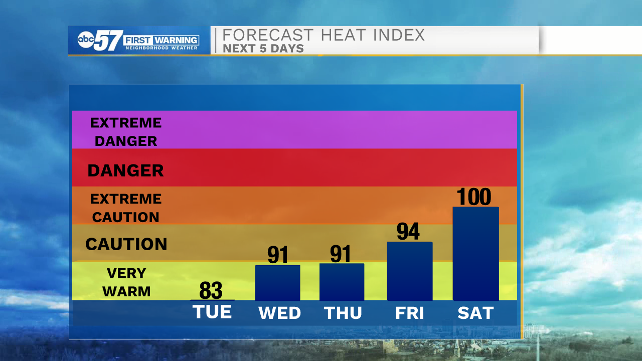
Plenty of sunshine today but temperatures begin to rise, topping out in the mid-80s. The humidity builds in as well towards the middle of the week with thunderstorms moving in after midday Wednesday. These storms could be strong with gusty wind and heavy rain. A few showers could linger into early Thursday morning, otherwise clouds clear out. We wrap up the rest of the week with sunshine but it gets hot! Daytime highs return to the 90s. The heat and humidity will make for a good recipe of pop-up thunderstorms over the weekend.
Today: Mostly sunny. High 86.
Tonight: Mostly to partly clear. Low 67.
Wednesday: Partly cloudy, afternoon/evening thunderstorms. High 88.
Thursday: Early shower possible then clearing skies. High of 86.