Two blasts of truly bitter, arctic air heading our way
 Air coming straight from the Arctic and Northern Canada is heading for the Midwest and Great Lakes twice over the next week.
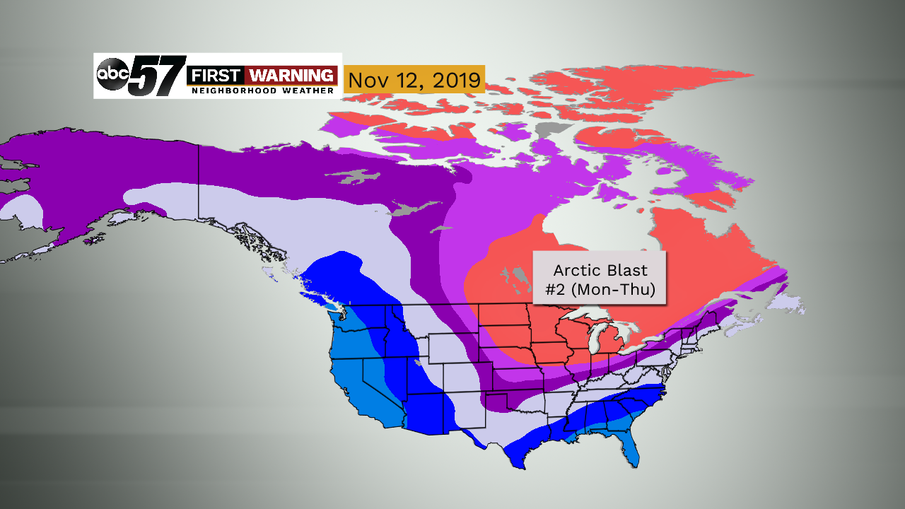
The air set to invade the Midwest, Great Lakes, Ohio Valley, and Northeast over the next week or so is coming directly from the Arctic Circle.
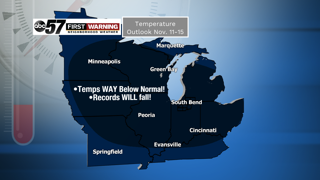 Probability of below normal temperatures between November 11th and 15th is as high as it gets.
That does not happen all that often.
1. November 7th and 8th
2. November 11th-14th (possibly even longer)
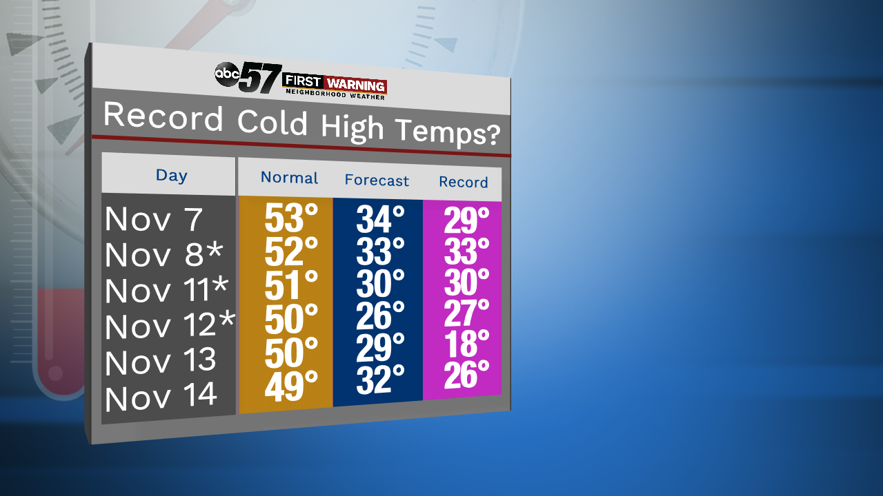
That's when many temperature-related records will fall across the Midwest, Great Lakes, Ohio Valley, and Northeast.
Michiana will be included. We will likely break or come very close to breaking a few records for cold high temperatures and cold overnight low temperatures.
 Forecast temperatures for November 10th to 15th.
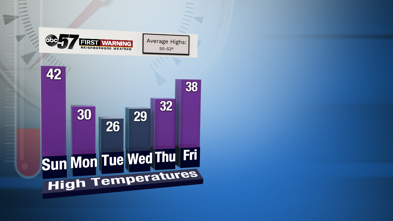
That puts the area anywhere from 15° to 30° below normal. That is a huge temperature differential, and incredible cold for early November.
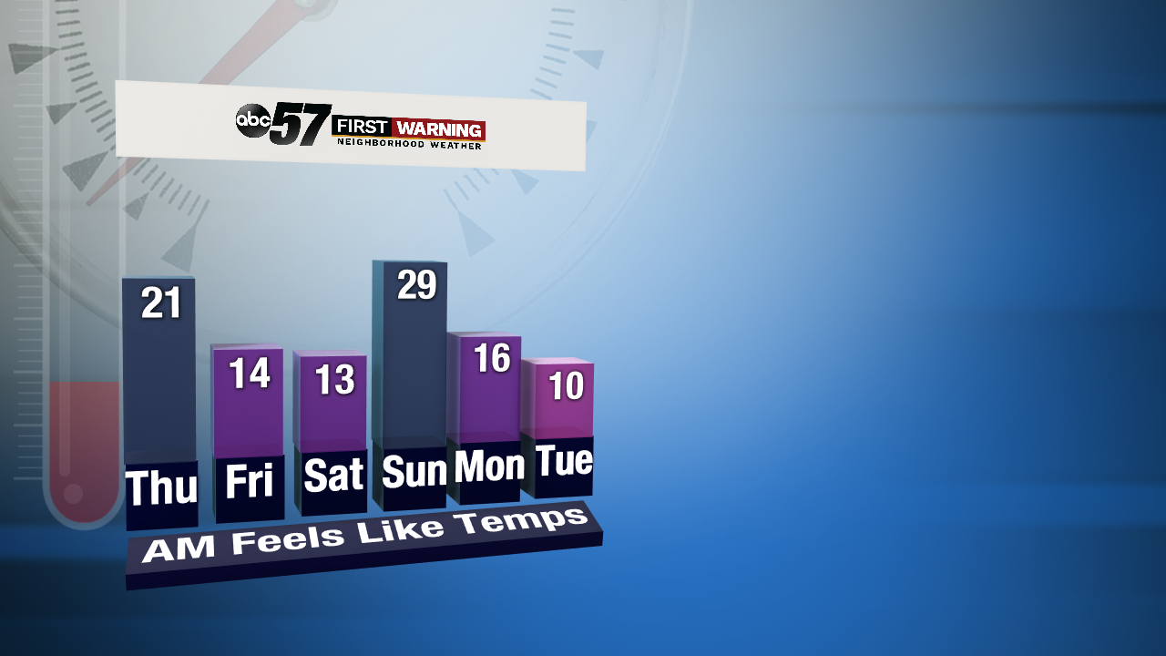 Forecast minimum wind chills during the morning hours between November 7th and 12th.
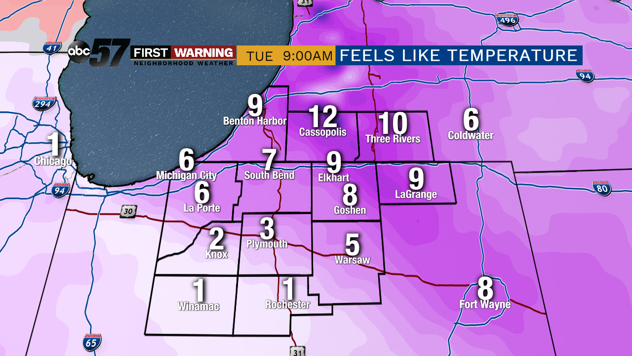 Potential feels like temperatures during the morning of November 12th.
Put simply, we are in for a true shock to the system for the next week, if not longer. There are signs of a possible pattern flip by later in the month, but that is by no means certain at this point.
