Upcoming heat to enter "extreme caution" and "danger" categories
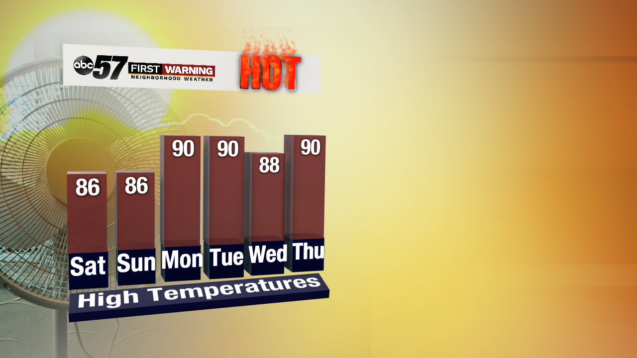
Hopefully you're a fan of big heat and tropical humidity. Mother Nature is getting ready to send us a lengthy stretch of Key West-like weather. In other words, daily highs of 87-94° and dew points staying near or above 70°.
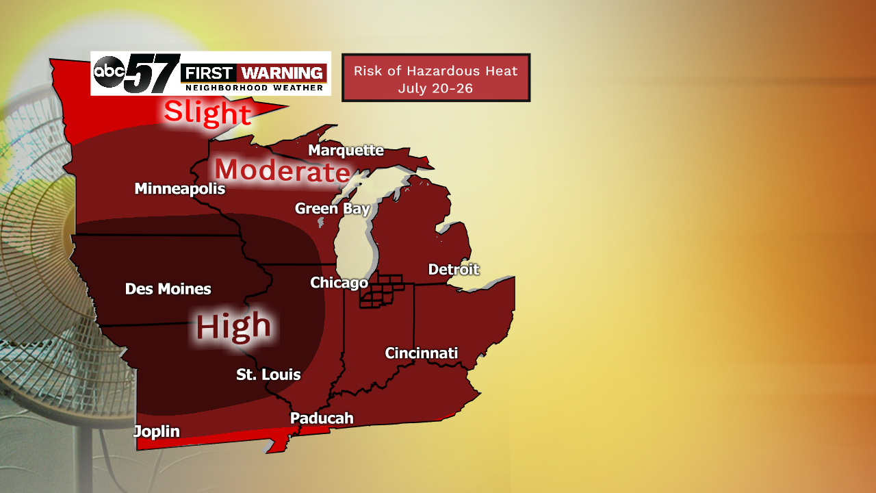
We have seen stretches of upper 80s and lower 90s over the last several years. It's not that uncommon to see a 3-5 day stretch of such temperatures. This particular heatwave, though, will be accompanied by very high humidity values, which will make it feel uncomfortable to simply disgusting outside. While it will certainly be very warm to hot this weekend, the true "big-time" heat and humidity don't arrive until next week. The entire week is setting up to be very hot and sticky. It doesn't end there, though. Most forecast models maintain highs around or above 90° and dew points in the 70s through at least the 22nd.That's why all of the Great Lakes region is under a "moderate" risk of hazardous heat for the period July 20-26th. That essentially means we should expect heat that can be dangerous to humans, pets and possibly infrastructure for at least 1-2 days during that period.
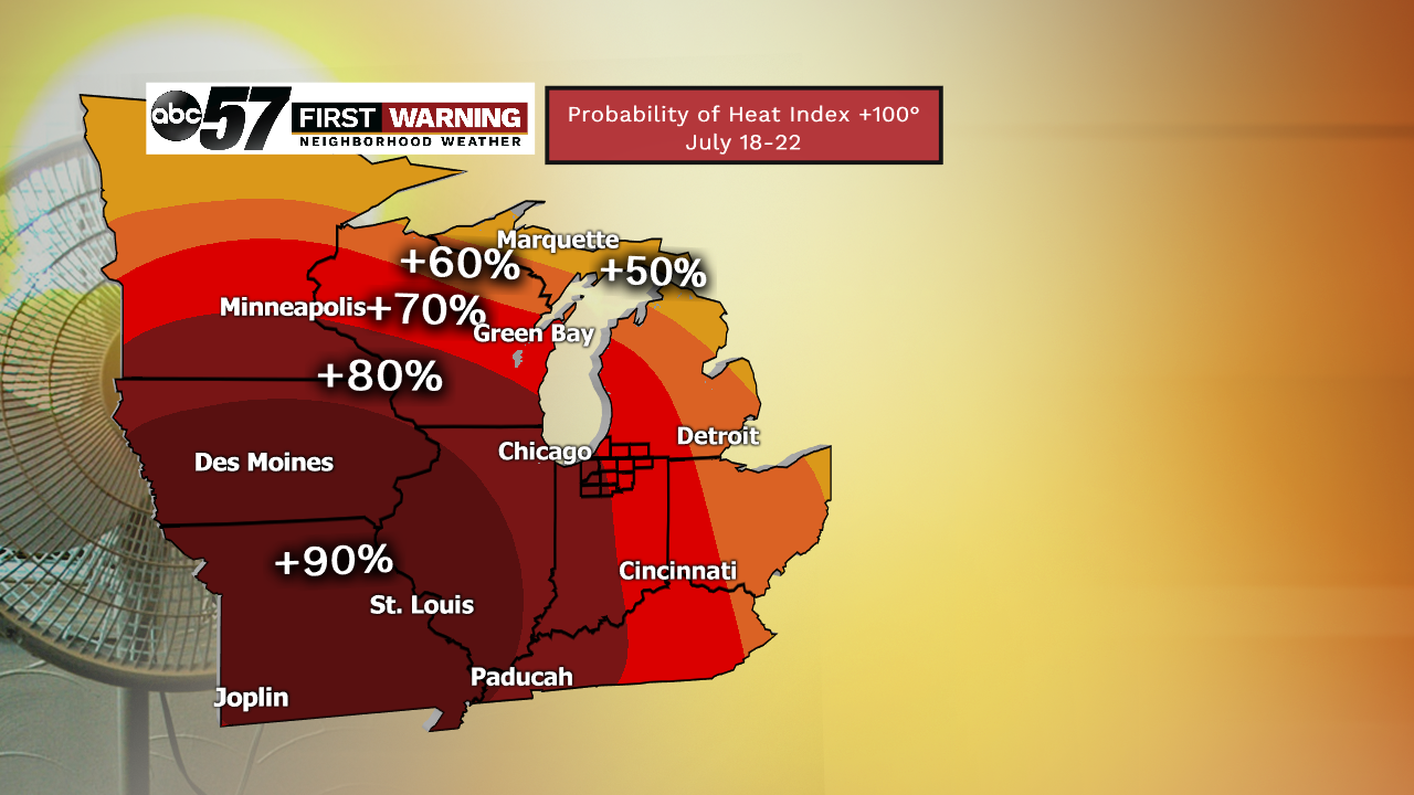
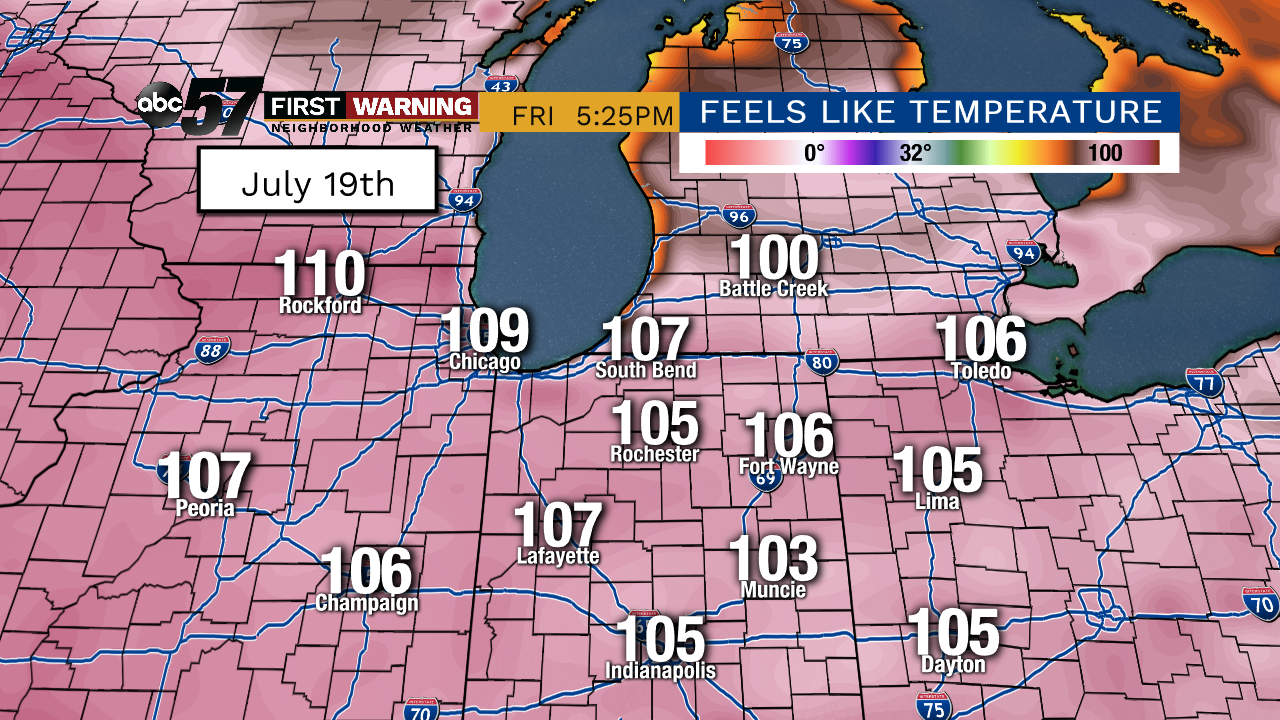
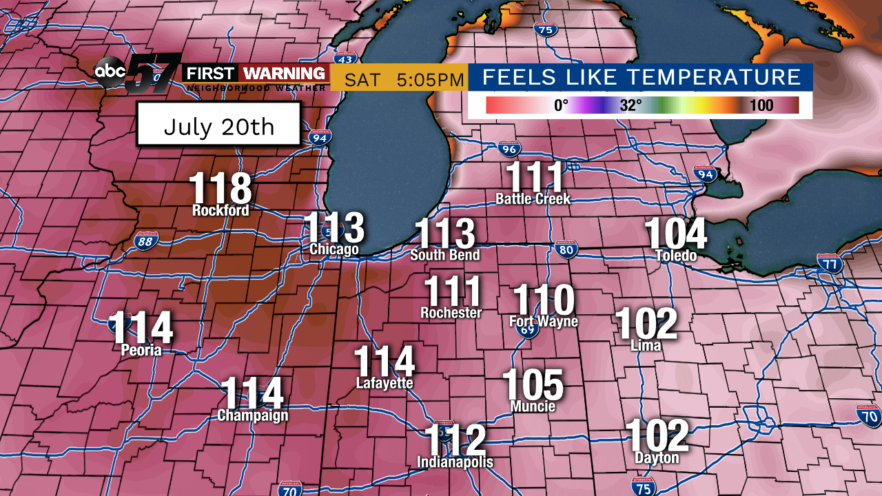
So how hot is that? As of now, all of Indiana and Southwest Michigan falls under a 70-90% chance of seeing at least one day with a heat index above 100° during the period July 18-26th. In all likelihood, there will be multiple days with "feels like" temperatures soaring above the century mark. The absolute worst of the heat looks to be from Thursday the 18th to Sunday the 21st. That's when heat index temps could easily rise above 100° area-wide. Most long-range forecast models are spitting out values higher than that. We're talking values like 105° to as high as 113° being suggested by models. Of course, it's important to remember that we are several days out, and these values could certainly change. And sometimes models overdo heat index temperatures just a bit.However, this forecast isn't one that just popped up overnight. Models have continued advertising a dangerous heatwave day after day across the Great Lakes and Midwest. That's why confidence in hazardous heat over the next 1-2 weeks is rather high.
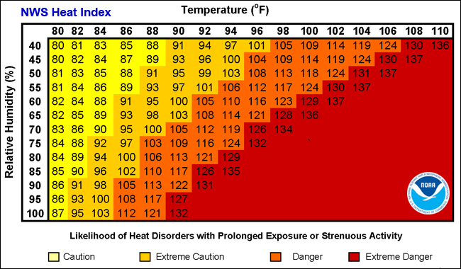
And it'll be heat that falls in the "extreme caution" to "danger" categories. Heat exhaustion, heat cramps, heat stroke and other illnesses will all be possible no matter how healthy someone is. And they can develop and become extremely dangerous or even deadly in short period of time.If you're curious, we have only seen heat index temperatures at or above 105° a total of 9 times over the last decade. And we haven't seen them that high since July 25th of 2012!

