
-
1:35

Warming up before storms arrive Thursday
-
2:06

Staying sunny until Thursday
-
0:58

Goshen City Council amends DORA rules amid community concerns
-
1:20

SB Common Council adopts Downtown 2045 Plan
-
2:39

Friends and family celebrate life of Jamecia Moffitt
-
1:15

St. Joseph County Council updates residents on Affordability...
-
0:51

Locals gather to recognize farmworkers across Northern Indiana
-
2:07

Impact of higher gas prices for delivery drivers
-
3:43

ND Eviction Clinic exposes ’shameful’ living conditions at...
-
3:59

Neighbors share traffic, noise concerns about proposed Capital...
-
1:50

Leaf pick up resumes in South Bend after weather postpones service...
-
1:02

Another rollercoaster ride to end the week

Wednesday starts with clouds and a chance of rain/snow showers, the precipitation impact will be minimal to none, only causing wet roads. Wednesday is cooler as highs struggle to break 40, then Thursday is milder with highs back in the 50s. The up-and-down pattern continues through the end of the week with a cold and breezy Friday ahead of what looks to be a fair and mild weekend, with highs near 60 by Sunday.
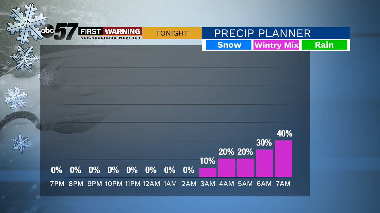

Tonight: Partly cloudy, early AM mix. Low 32.
Wednesday: AM chance rain/snow, then partly cloudy. High 42.
Thursday: Partly to mostly cloudy, PM rain chance. High 52.
Friday: Partly cloudy, breezy, high of 36.
Sign up for the ABC 57 Newsletter