


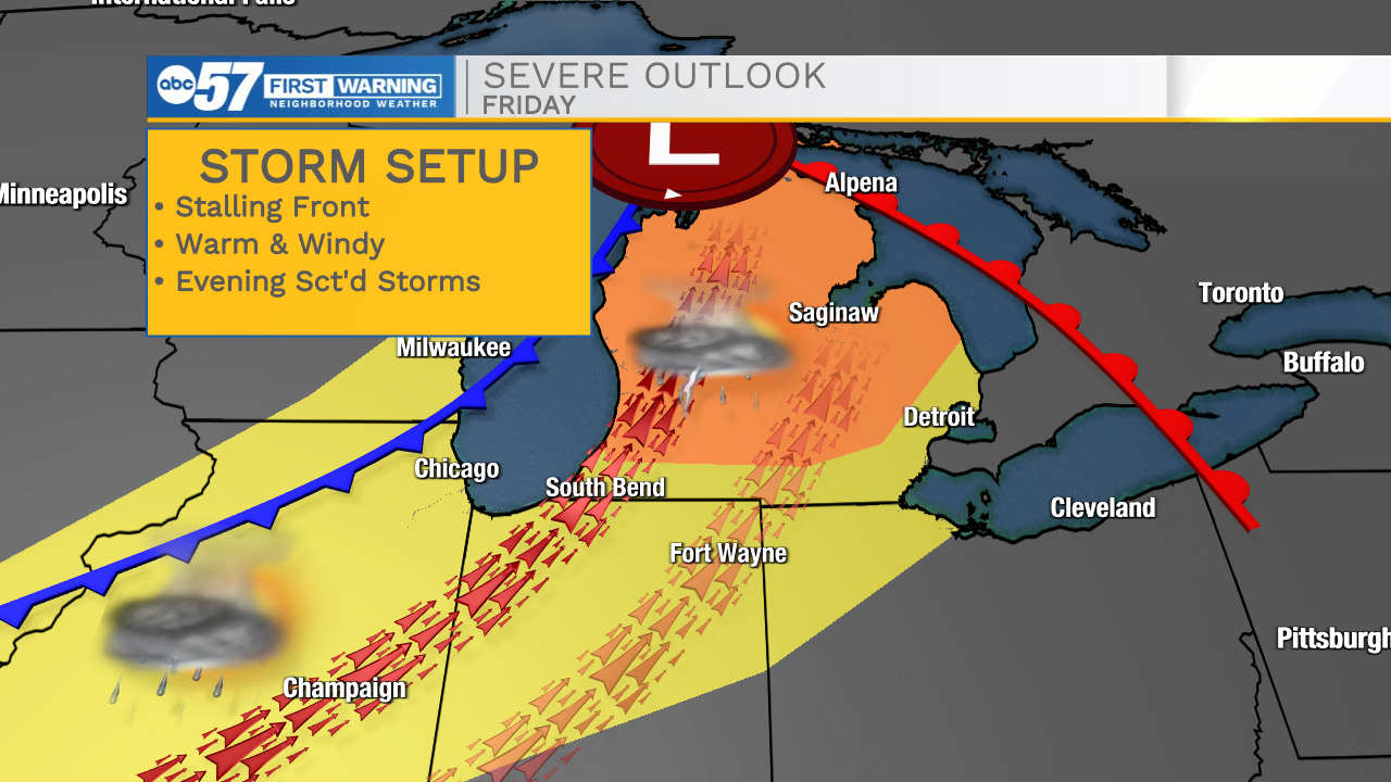
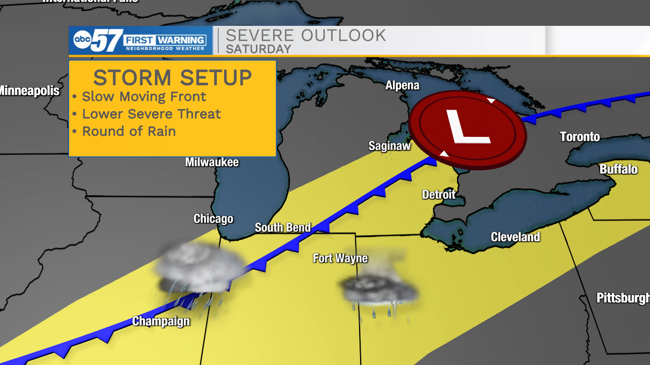
The Focus on Friday has shifted to Saturday, with what is now evolving into more of a heavy rain, less of a severe thunderstorm threat. Friday is hot, humid, and breezy as temperatures surge near 90. There could be an isolated morning thunderstorm, but the daytime hours are likely dry. A cold front slowly moves into the area Friday evening, and the chance of rain increases into Saturday morning. The timing lowers the severe threat, minus a few isolated cells Friday evening, rain with downpours is more likely Saturday morning. A slow-moving front could mean multiple rounds of heavy rain during the day Saturday, lasting into the evening. Drier, and milder weather returns Sunday.
Tonight: Partly cloudy, becoming humid. Low 68.
Friday: Breezy, PM T-Storms. High 88.
Saturday: Rounds of rain / T-showers. High 68.
Sunday: Partly cloudy. High 62.
Monday: Mostly sunny. High 66