Warm ground makes accumulating snow less likely this weekend


It's that time of year! Temperatures are (finally) starting to get chilly, the leaves are falling, and our winter weather models are shaking off the cobwebs and starting to paint some snow totals across the area.
Hold your horses, Michiana.
Yes, some snowflakes are likely this weekend. Yes, it will be much colder across Michiana. And, yes, it will look a little more like winter.
However, accumulating snowfall is very unlikely for most of us, even with multiple storm systems on the way.
The next fall storm hits Thursday afternoon ????
— Tom Coomes (@TomCoomes) November 9, 2021
The leaves will fall along with the temperature. Wind, rain and even some snow is possible, though accumulation is unlikely.https://t.co/81y0RPW0Tf | #inwx #miwx pic.twitter.com/oGJ77iEqfW
A major factor in our skepticism is how warm ground temperatures are. As of Tuesday morning, all of Michiana had ground temperatures of more than 40 degrees. Some spots in southwestern Michigan even had readings in the 50s!
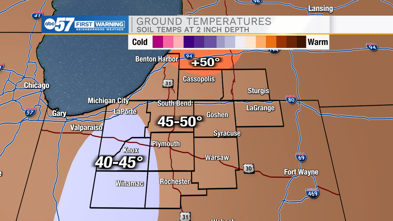
Ground temperatures respond slower than air temperatures do, taking days if not weeks to see significant change. Even if Mother Nature somehow dumped a bucket of snow on Michiana right now, it would all melt as soil temperatures are nearly 20 degrees above the freezing mark.
Additionally, air temperatures won't be that cold, either. Low temperatures leading up to the snow will still be well-above freezing, and even as the coldest air gets here, thermometer readings will barely dip below 30.
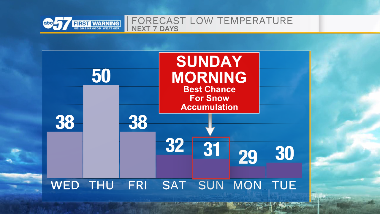
The bottom line: even if there is some minor accumulation across Michiana this weekend, impacts to you and your day will be minimal.
You might be out at the right time to catch a few snowflakes sticking to your roof or your car windshield on Sunday. However, you won't have to dip into your true winter arsenal.
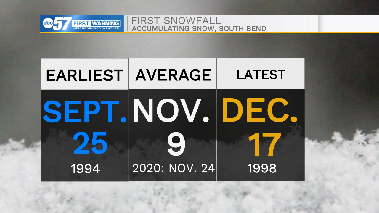
South Bend's first typical accumulating snow is November 9. So while these snowflakes will mostly just provide groans and eye rolls, it may not stay that way for very long!